World Space Week Day 1 – Welcome to World Space Week 2022!
In early October every year, World Space Week is run, celebrating the space industry and science’s contribution to humanity. The start and end dates mark the launch of Sputnik I, the first man-made satellite, and the signing of The Outer Space Treaty – the first international agreement on the exploration and use of space. In...Continue reading→
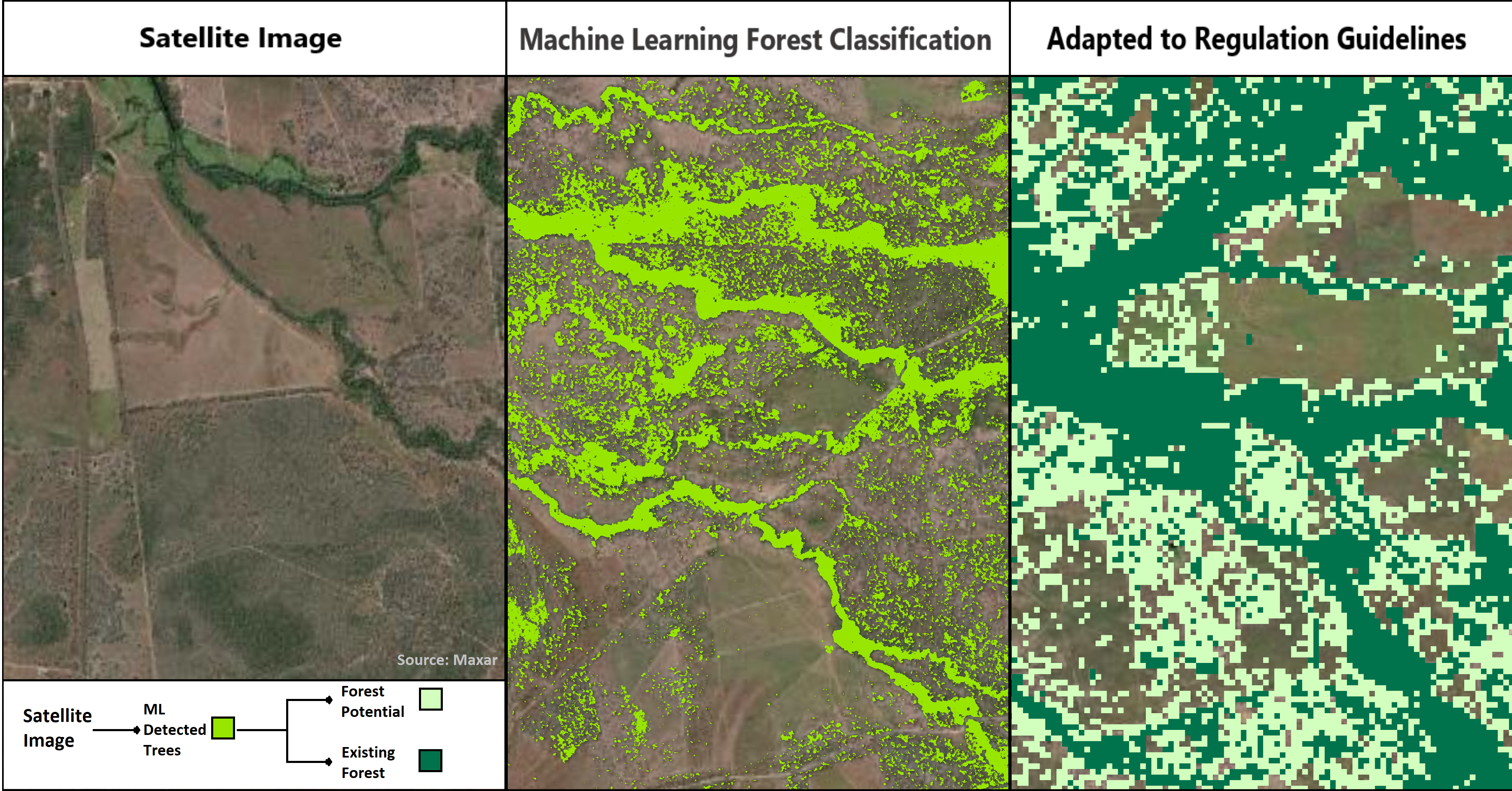
World Space Week Day 2 – Carbon Accounting
For Day 2 of World Space Week, we will be investigating how GI contributes to Carbon Accounting here in Australia. Several of the UN sustainable development goals relate directly to the health of the environment, including a commitment to climate action, and protecting marine and terrestrial environments; all of which are either directly or indirectly...Continue reading→
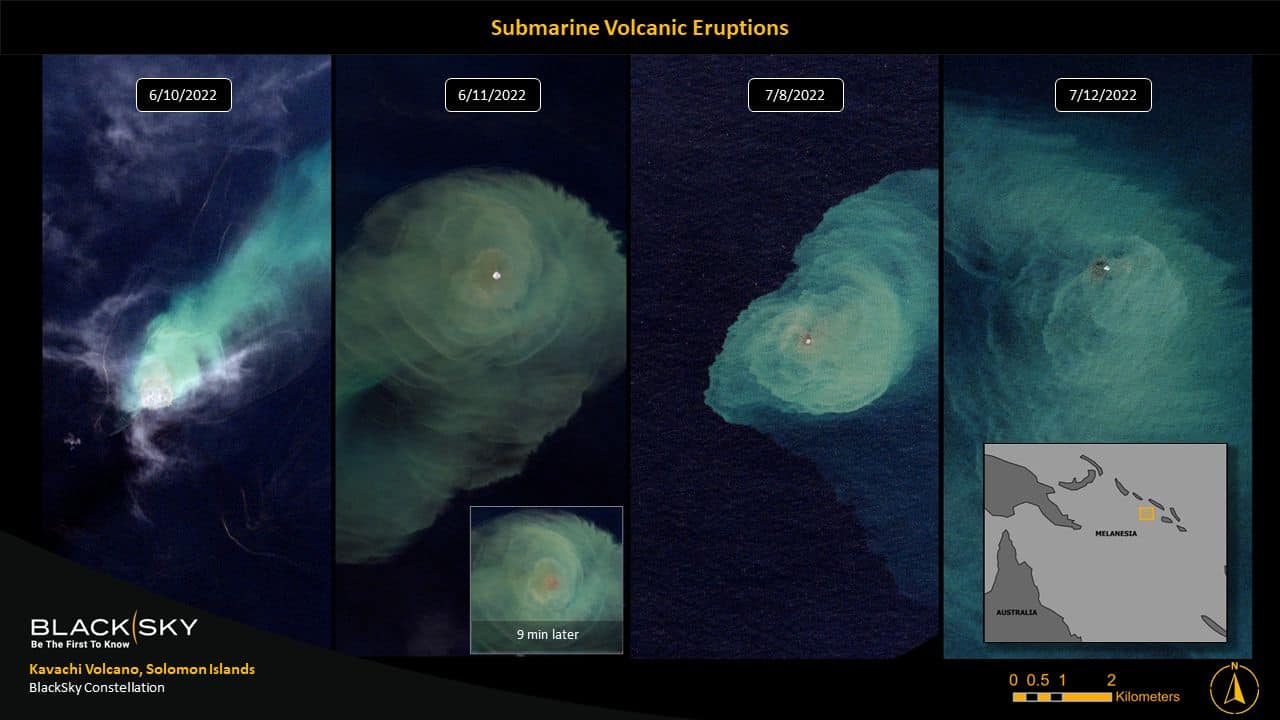
Supplier-in-Focus (October): BlackSky
Welcome to the second instalment of our ‘Partner-in-Focus’ post! Each month, GI will be highlighting one of our Partners over our social media channels. Our Partner-in-Focus for October is BlackSky. BlackSky provides real-time, dynamic monitoring to the most critical and strategic locations, economic assets, and events on Earth. BlackSky’s two imagery services – ‘BlackSky On-Demand’ and...Continue reading→
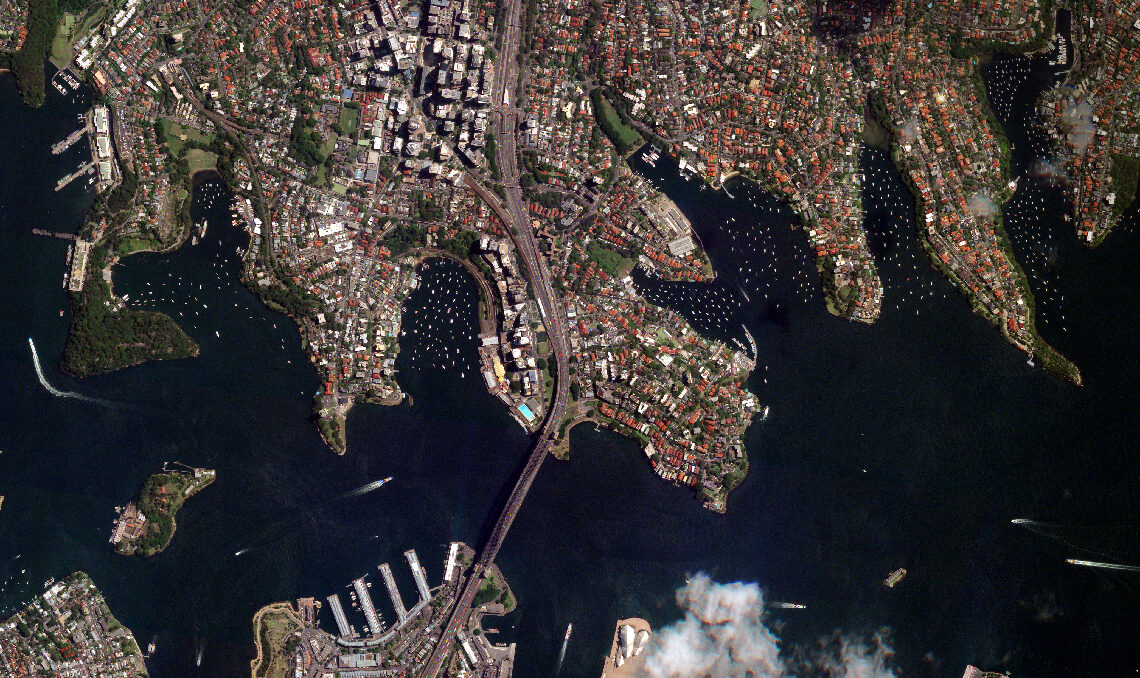
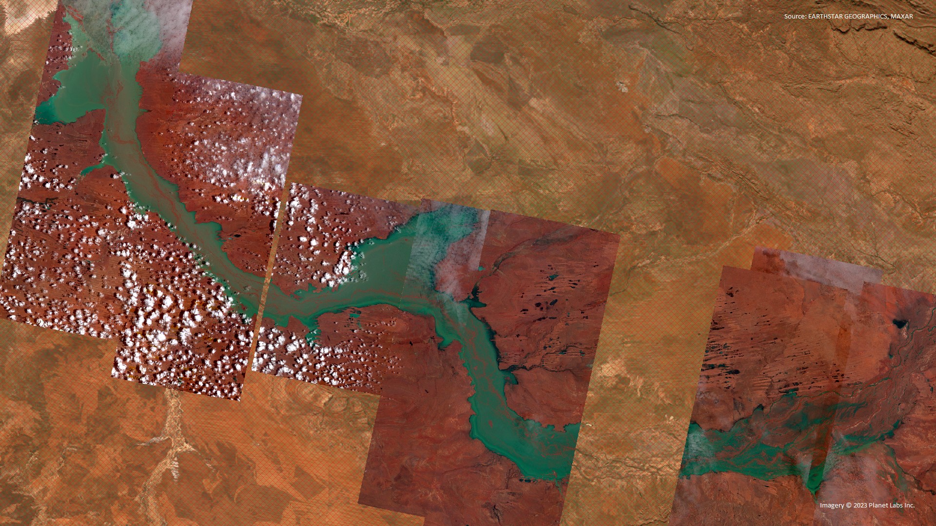
Geospatial Intelligence Announce New Partnership With Satellogic
Geospatial Intelligence Pty Ltd are excited to announce a new partnership with Satellogic, a leading global provider of high-resolution satellite imagery. Satellogic designs, builds and operates its own fleet of Earth Observation satellites to collect affordable, high-resolution imagery. Its 4 multispectral bands (red, green, blue, near-IR) are delivered ortho-rectified and GIS-ready, available 70cm resolution on...Continue reading→
Living with the Impacts of Climate Change: How satellite intelligence is revolutionising our response to natural disasters
Climate change has become one of the biggest imminent threats to human safety and security in the 21st century. We are required therefore to adapt to these changing conditions, and develop solutions that allow us to manage and quantify the effects of natural disasters faster and much more efficiently. Geospatial Analyst Jeremy Repetto sat down with Geospatial...Continue reading→
Spatial Apps
Spatial Apps has undergone a transformative evolution and emerged as Geospatial Intelligence (UK), proudly joining the esteemed Geospatial Intelligence group. Building upon their expertise in GeoAI, analytics, and location intelligence, Geospatial Intelligence (UK) has positioned itself as a specialist in harnessing the power of geospatial data for unparalleled insights and strategic decision-making. Despite its integration...Continue reading→