Tailor-made Software for Aircraft Surveillance Analytics and Near-Realtime SA/C2
ATLAS is a web-based platform designed to deliver near-realtime aircraft surveillance and true global situational awareness.
By combining satellite ADS-B, independent position estimation, GNSS interference analysis and geospatial datasets, ATLAS turns complex airspace data into clear, actionable intelligence. It enables organisations to monitor activity, understand behaviour and make confident decisions, faster.
Built for operational environments, ATLAS goes beyond visibility. It gives you the context behind the movement, so you’re not just tracking aircraft, you’re understanding what’s happening and why.
What Atlas does
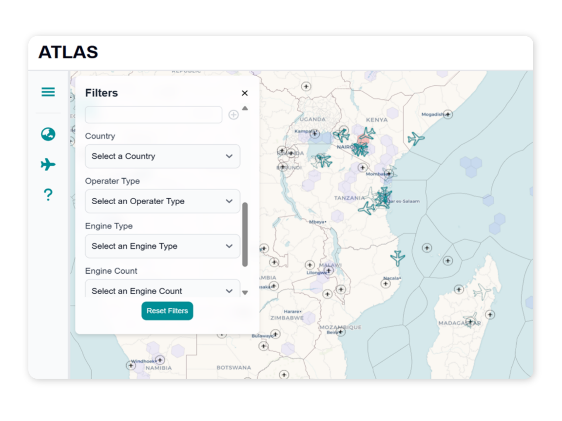
Near Realtime Situational Awareness
Global Coverage. Near-realtime data.
ATLAS delivers a true global, spaced based, near-realtime view of airspace, powered by real aircraft position data, not estimation, across both populated and remote regions.
Unlike traditional platforms, ATLAS provides coverage across the entire globe, from the middle of the Pacific to outer Siberia.
With independent position estimation (VECTOR), it adds an extra layer of confidence, verifying aircraft locations and supporting faster, more informed decisions.
Advanced Search & Data Enrichment
Find What Matters, Faster.
ATLAS combines multiple datasets to create richer, more complete aircraft profiles.
Search across a wide range of attributes and filter intelligently based on data availability, ensuring you’re only working with relevant, reliable information. This enables faster identification, investigation and decision-making.
Event Detection & GNSS Interference Insights
Detect Behaviour. Not Just Movement.
ATLAS identifies key events based on behavioural patterns over time, not just single data points, including:
- Take-offs and landings
- Altitude and speed transitions
- Changes in operational behaviour
Reveals GNSS interference patterns and, with VECTOR, identifies discrepancies and potential spoofing in aircraft location data.
Derived Intelligence & Continuous Analytics
From Movement to Meaning.
ATLAS transforms raw aircraft data into meaningful insight through continuously updated analytics, including:
- Calculated and inferred speed
- Estimated origins and destinations
- Airspace and EEZ positioning
- Over-land and over-ocean activity
By enriching data in near-realtime, ATLAS helps you move beyond tracking into true understanding.
Interactive Map Interface
Precision at Every Zoom Level
ATLAS is designed for both rapid monitoring and deep investigation.
- High-level visibility when zoomed out
- Detailed aircraft insights when zoomed in
- Built-in tools for measurement, layering and exploration
Whether you need a quick operational snapshot or a deeper analysis, ATLAS adapts to how you work.
Get Global ADS‑B Visibility in Seconds
Talk to our team about how global ADS-B intelligence provide the information you need