
Geospatial Intelligence Pty Ltd Included in 2018 Australian Military Sales Catalogue
Tuesday 20 March 2018 Today, the Hon Christopher Pyne MP, Minister for Defence Industry, launched the 2018 Australian Military Sales Catalogue at Parliament House. Geospatial Intelligence CEO, Rob Coorey, attended the event in recognition of the company’s inclusion in the catalogue. Companies listed in the catalogue needed to satisfy a number of criteria, including: the...Continue reading→
Geospatial Intelligence Proud to Support Sir John Monash Centre
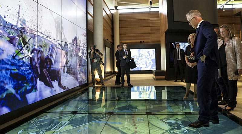
Australian Prime Minister, Hon Malcolm Turnbull, admires the digital displays at the new Sir John Monash Centre in Villers-Bretoneux, including a topographic map of the surrounding area produced by EyeCandy Animations with base imagery provided by Geospatial Intelligence. This project was supported by the Department of Veteran’s Affairs, and raw imagery was provided by DigitalGlobe....Continue reading→
Celebrating 15 Years of Supporting Defence, Government and Industry to Make Intelligent Decisions
15 years ago, Geospatial Intelligence Pty Ltd founder and CEO, Rob Coorey, had a vision to “Assist clients to collect, analyse and interpret, location-based information that could support them in their decision-making processes”. Today Rob leads a core team, plus consulting experts and researchers, that have turned this vision into a reality. Rob has a...Continue reading→
Australian Space Company Delivers
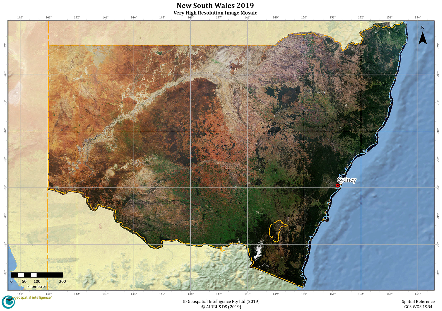
Australian space company, Geospatial Intelligence, has entered into a worldleading partnership, delivering up to date state-wide, very high-resolution satellite image mosaics to the New South Wales Government, which will assist in analysing drought and bushfire affected areas. Geospatial Intelligence Pty Limited, who are specialists in the provision and analysis of very high-resolution imagery; have partnered...Continue reading→
Australian Space Awards Nominations
The team at Geospatial Intelligence Pty Ltd are pleased to share the news that we have named as finalists in 5 categories for the Space Connect Australian Space Awards to be held in March. Our team were grateful to receive numerous nominations and would like to thank those in the industry for recognizing us in...Continue reading→
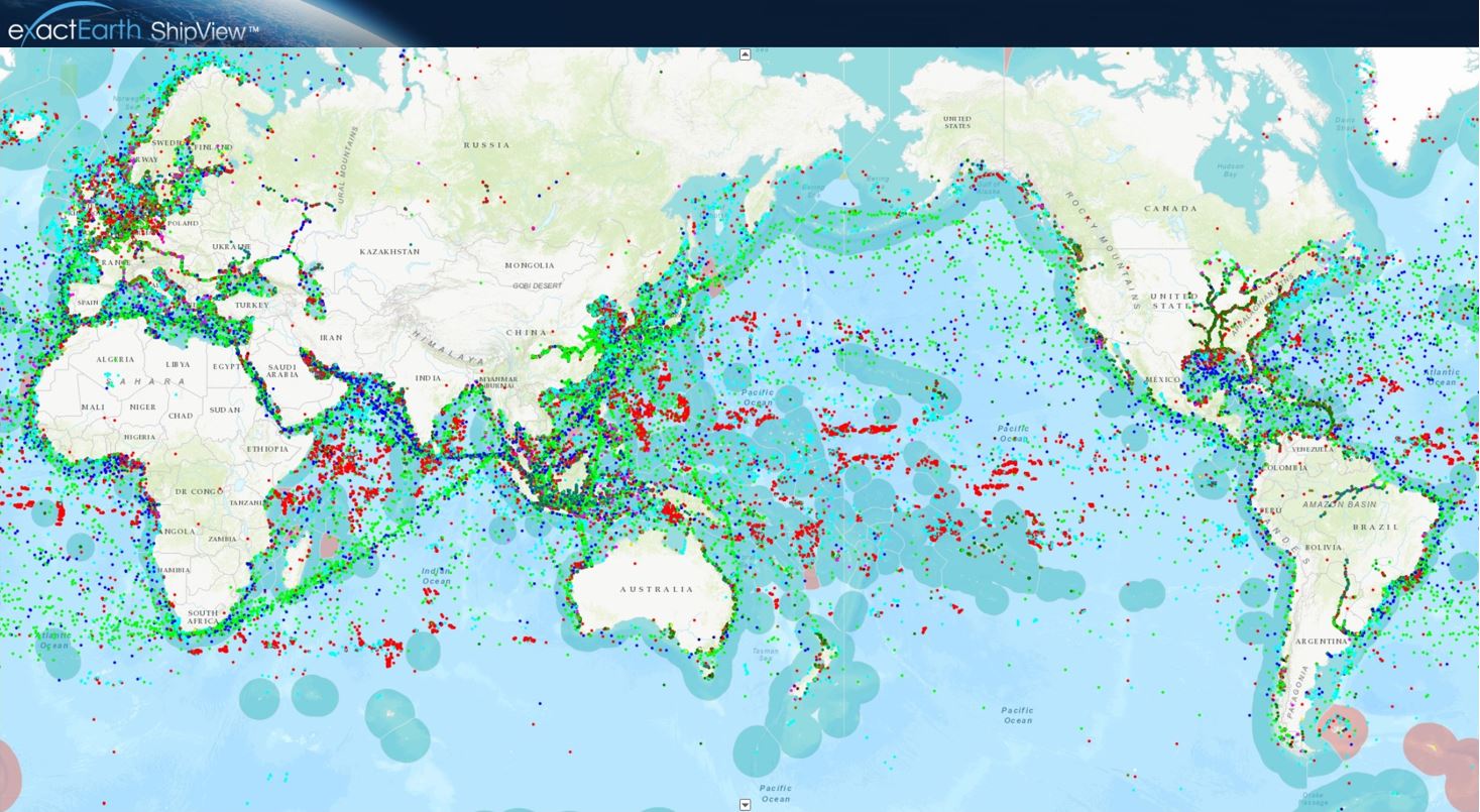
Tracking COVID 19 from space
Could you track where you have been in the past 17 days? In light of the Covid-19 pandemic and the heightened interest in cruise liners, the team at Geospatial Intelligence Pty Ltd have been tracking cruise ship vessels within Australian waters using exactEarth® ShipView. Every AIS transmitting vessel globally viewable on exactEarth® ShipView Satellite Automatic...Continue reading→
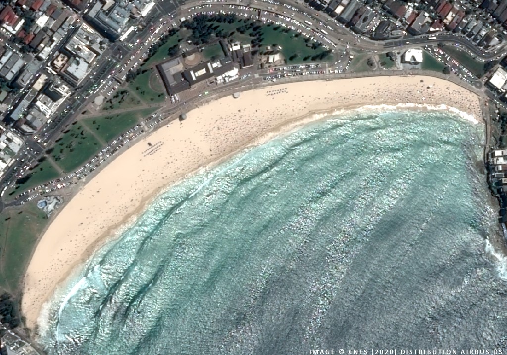
COVID-19 in Australia from Space
One of the many potential applications of remotely-sensed data from commercial very high-resolution satellite sources is that of change detection. The ability to quickly and accurately detect changes on the Earth’s surface is critical for understanding interactions between humans and our natural or urban environments. Remote sensing techniques that utilise very-high resolution satellite imagery have...Continue reading→
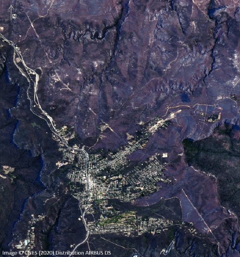
Black Summer from Space
Very-high resolution satellite imagery can be a powerful tool for monitoring the impact of environmental disasters. In this particular case, we have utilised 1.5m imagery which was captured pre and post fire. By applying remote sensing techniques, this multispectral satellite imagery provides an opportunity to investigate fire behaviour, drought, fire intensity and land management. Continue reading→
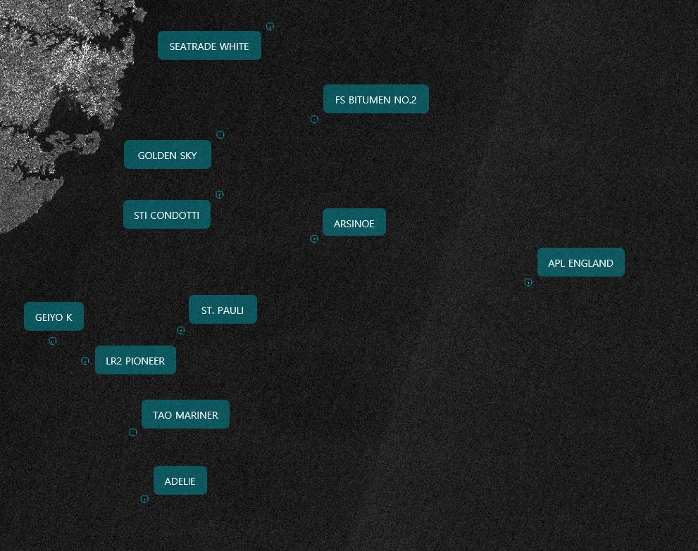
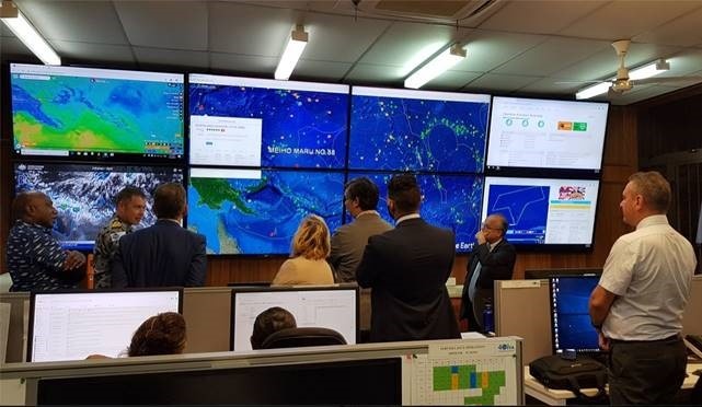
Maritime Domain Awareness Detection and Modelling
It was recently reported in the media that a container vessel, the APL ENGLAND, lost a large number of containers overboard during a storm early on Sunday 24 May off the coast of New South Wales. At the time, the ship was on a journey from Ningbo, China to Melbourne, Australia. Whilst caught in a...Continue reading→

Unlocking Maritime Domain Insights using Machine Intelligence (MI)
The detection of unlawful fishing, oil spills and other illicit activity may require area monitoring or a quick reaction to a looming hazard. Geospatial Intelligence (GI) uses Artificial Intelligence (AI) algorithms on earth observation imagery, fused with Satellite Automatic Identification Systems (AIS), to track vessels and report on their activity. Our services allow clients to...Continue reading→
Protecting the Pacific’s Fishery Resources from Space
Australian Company Geospatial Intelligence Pty Ltd, Maritime Domain Awareness experts, in collaboration with exactEarth (Canada), have recently renewed their contract to provide Satellite Automatic Identification System (S-AIS) technology and data to the Pacific Islands Forum Fisheries Agency (FFA) for another 3 years. “We are very proud of our decade long relationship with exactEarth, which represents...Continue reading→

Australian Space Company – aids in bushfire recovery
Australian space company, Geospatial Intelligence Pty Ltd, has continued its world-leading partnership with Geoimage Pty Ltd and Airbus Defence and Space, to deliver to the New South Wales Government, a second up-to-date, very-high resolution satellite image mosaic over the entire State. Geospatial Intelligence Pty Limited, specialists in the provision and analysis of very high-resolution...Continue reading→