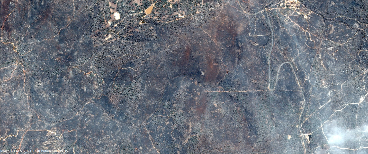
WA Wildfires – satellite imagery delivered in a timely manner.
Australian space company, Geospatial Intelligence Pty Ltd, has continued its well-honed partnership with Airbus Defence and Space to rapidly deliver essential imagery to the Western Australian Government, in response to the Wooroloo bushfire emergency impacting the state in early 2021. Geospatial Intelligence promptly met the specified requirements of the Western Australian emergency services to provide […]
WA Wildfires – satellite imagery delivered in a timely manner. Read More »