Automatic Dependent Surveillance-Broadcast (ADS-B)
Real-time aircraft tracking and air-domain intelligence
Geospatial Intelligence provides access to global ADS-B data to support aviation monitoring, security operations, intelligence analysis and situational awareness. By integrating ADS-B with satellite imagery, AIS, OSINT and analytics, we deliver a complete picture of air and maritime activity – anywhere on the planet.
ADS-B enables continuous tracking of aircraft identity, position, altitude, speed and heading. Satellite-based ADS-B extends coverage far beyond terrestrial receivers, providing persistent visibility over oceans, remote regions and high-risk air corridors.

Satellite ADS-B coverage
We integrate ADS-B feeds into dashboards, analytical tools and intelligence workflows to support both operational monitoring and long-term pattern analysis
-
Visibility
Global aircraft visibility, including remote and oceanic regions
-
Flight Data
Low-latency real-time and historical flight data
-
Coverage
Coverage beyond the reach of ground-based radar
-
Tracking
Reliable tracking for commercial, general and selected government aviation
Case Studies
Australian Space Awards Nominations
The team at Geospatial Intelligence Pty Ltd are pleased to share the news that we have named as finalists in 5 categories for the Space...Continue reading→
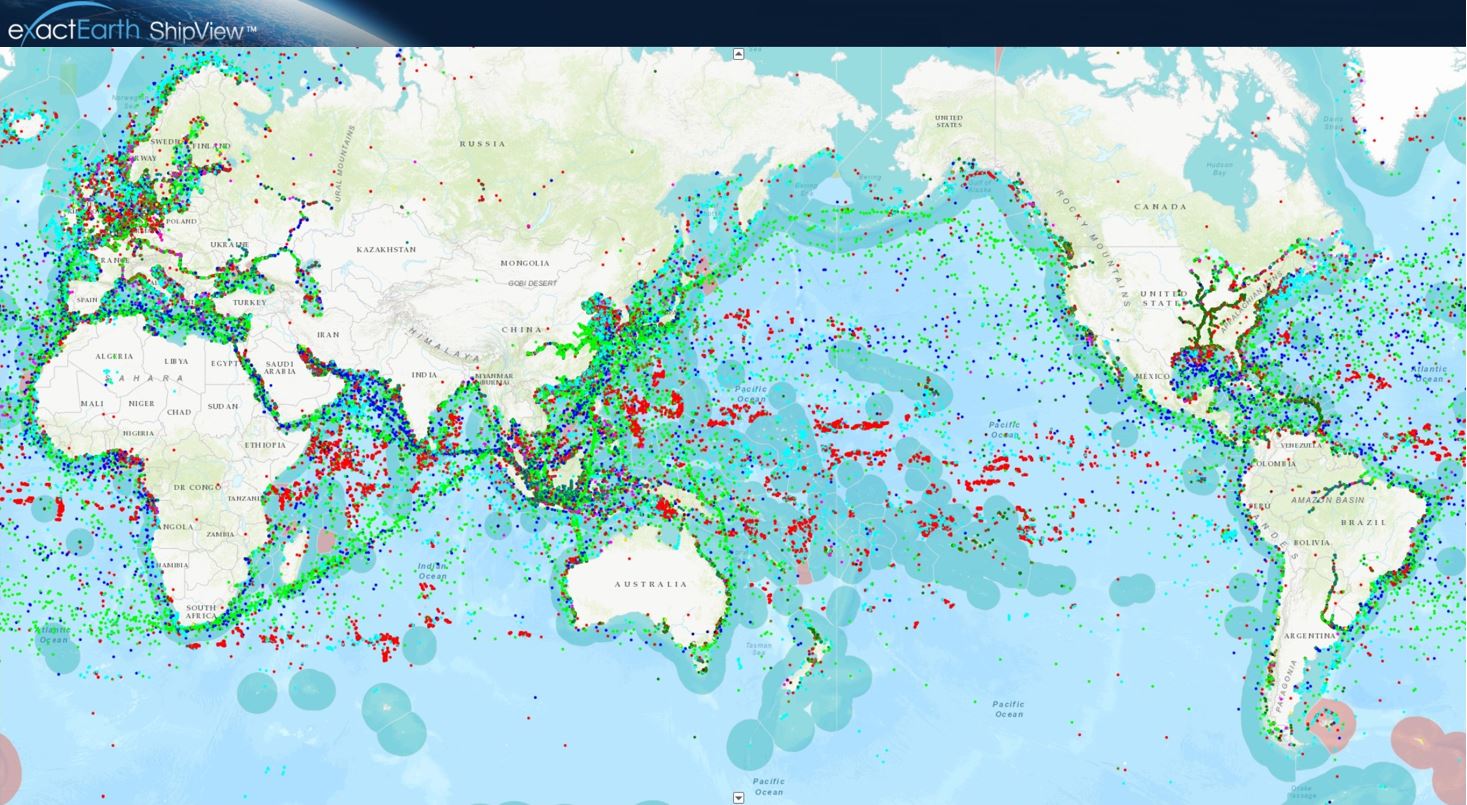
Tracking COVID 19 from space
Could you track where you have been in the past 17 days? In light of the Covid-19 pandemic and the heightened interest in cruise liners,...Continue reading→

Why ADS-B matters
ADS-B allows organisations to:
- Monitor global aircraft movements in near real time
- Enhance air-domain awareness and operational planning
- Detect unusual flight behaviour or unauthorised activity
- Support border protection and security operations
- Improve emergency response and search-and-rescue coordination
- Combine air-tracking data with imagery and OSINT for deeper intelligence
Enhance air-domain awareness with trusted ADS-B intelligence
Get expert guidance on aircraft tracking data, coverage options and how ADS-B can be integrated with imagery, maritime data and open-source intelligence to support your mission
