

The Challenge
An aviation monitoring team identified three aircraft operating within the same area that appeared to be exhibiting unusual navigation behaviour.
Initial observations suggested that all three aircraft may have been affected by GNSS interference. However, ADS-B position reporting alone could not determine whether the issue was caused by aircraft-specific equipment problems, broader environmental conditions, or something else entirely.
The team needed to identify which aircraft genuinely required further investigation and which could be safely excluded.
The Atlas approach
Analysts first used Atlas to review aircraft operating within the area of interest.
Three aircraft were identified for further examination.
Using the Aircraft Details page, analysts reviewed:
- ADS-B signal quality indicators
- VECTOR-derived positioning
- Historical aircraft behaviour
- Recent flight activity
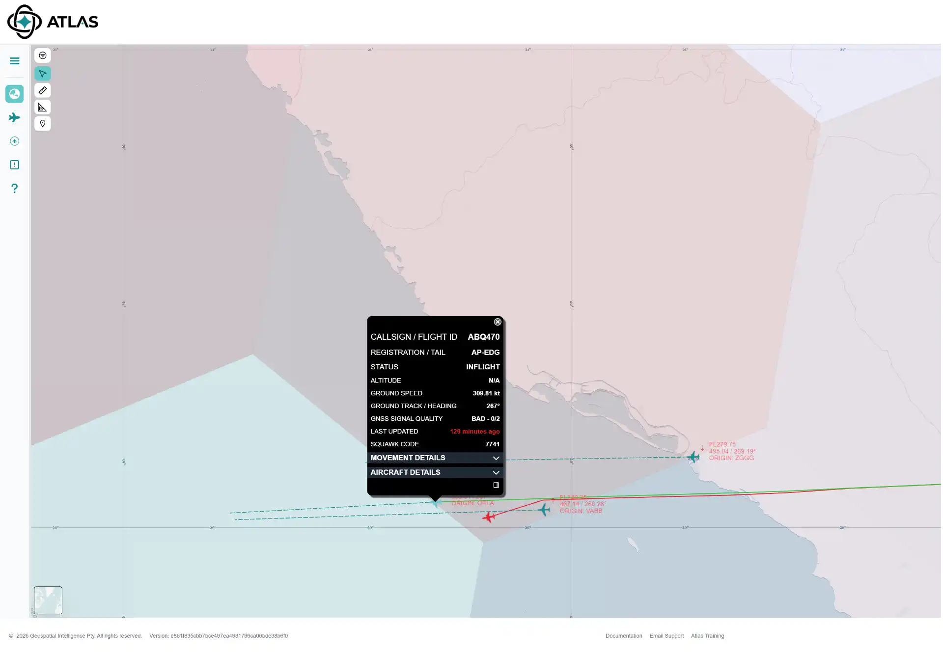
The analysis quickly showed that only one of the three aircraft was reporting degraded GNSS quality.
The remaining two aircraft continued to report normal GNSS performance and displayed no unusual positioning characteristics.
Analysts then reviewed the VECTOR data for the aircraft with degraded GNSS quality.
In addition to the poor GNSS quality indicators, VECTOR showed an increasing separation between the aircraft's reported ADS-B position and its independently calculated VECTOR position. This divergence provided an additional line of evidence that the aircraft's reported position may not have been fully reliable.
The Challenge
An aviation monitoring team identified three aircraft operating within the same area that appeared to be exhibiting unusual navigation behaviour.
Initial observations suggested that all three aircraft may have been affected by GNSS interference. However, ADS-B position reporting alone could not determine whether the issue was caused by aircraft-specific equipment problems, broader environmental conditions, or something else entirely.
The team needed to identify which aircraft genuinely required further investigation and which could be safely excluded.
Outcome
By combining aircraft-reported GNSS quality information with independent VECTOR positioning, analysts were able to rapidly narrow the investigation from three aircraft to a single aircraft of interest.
The analysis suggested that the observed behaviour was more likely related to the affected aircraft's navigation solution than to a widespread environmental effect impacting all aircraft in the area.
Rather than investigating every aircraft operating nearby, the team could focus attention on the aircraft displaying multiple independent indicators of degraded positioning performance.
Why it matters
ADS-B tells you where an aircraft is reporting itself to be.
Atlas helps answer a more important question:
Is the reported position consistent with other evidence?
By combining satellite ADS-B, aircraft-reported GNSS quality indicators, and independent VECTOR positioning, Atlas provides analysts with multiple sources of evidence that can be used to identify aircraft requiring closer investigation while reducing false positives.