Imagery & Data
High-resolution geospatial data for confident decision-making
Geospatial Intelligence provides premium satellite imagery and geospatial datasets to support mission-critical operations across defence, government and commercial sectors. As a leading reseller for the world’s major satellite imagery providers, we deliver rapid access to new tasking and one of the world’s largest imagery archives.
Whether you need a single image or a fully integrated analysis pipeline, our specialists help you select the right sensor, resolution and acquisition strategy.

Our imagery & data offerings
Optical Imagery
Natural-colour intelligence for clear, detailed analysis
Access very high-resolution multispectral imagery ideal for environmental monitoring, mapping, infrastructure planning and change detection.
Use for: feature identification, vegetation health, land-use mapping, modelling.
Access data from over 40 satellite constellations, including Pléiades, Pléiades Neo, WorldView, GeoEye, SkySat, PlanetScope, BlackSky, Sentinel-2 and Landsat.
Basemaps, Elevation & Reference Layers
The foundation for accurate mapping and modelling
We supply high-quality basemaps, terrain models and GIS-ready layers that add spatial context to your analysis.
Use for: planning, simulation, terrain understanding, line-of-sight modelling, navigation.
Products include:
- Optical and SAR basemaps
- Digital Elevation Models (DEM), DSM, DTM
- Point clouds, contours and custom terrain datasets
- Street networks, building footprints, administrative boundaries
SAR Imagery
All-weather, day/night monitoring
Synthetic Aperture Radar penetrates cloud, smoke and darkness, delivering reliable insight when optical imagery cannot.
Use for: vessel detection, flood mapping, land deformation, persistent monitoring.
Access data from leading SAR constellations, including Capella Space, TerraSAR-X, TanDEM-X and Sentinel-1.
Advanced Image & Data Services
Transform raw data into actionable intelligence
Our analysts specialise in processing, analysing and fusing multi-sensor datasets including optical, SAR, multispectral, LiDAR, hyperspectral, thermal, AIS and OSINT.
We support:
- Pansharpening and orthorectification
- Mosaicking and colour-balancing
- Change detection and temporal analysis
- Environmental and infrastructure monitoring
- Oil spill and ship detection
- Feature extraction and classification
- Intelligence reporting and operational assessments
- Bespoke mapping and modelling products
Case Studies
Maritime Domain Awareness Detection and Modelling
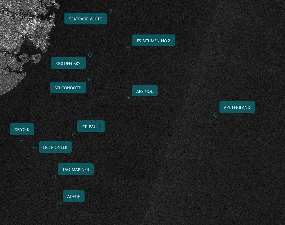
It was recently reported in the media that a container vessel, the APL ENGLAND, lost a large number of containers overboard during a storm early...Continue reading→
Unlocking Maritime Domain Insights using Machine Intelligence (MI)
The detection of unlawful fishing, oil spills and other illicit activity may require area monitoring or a quick reaction to a looming hazard. Geospatial Intelligence...Continue reading→
Need the right imagery for your project? Our specialists are here to help
Get fast access to the right data, from the right sensor, at the right time
