Imagery & Data
High-resolution geospatial data for confident decision-making
Geospatial Intelligence provides premium satellite imagery and geospatial datasets to support mission-critical operations across defence, government and commercial sectors. As a leading reseller for the world’s major satellite imagery providers, we deliver rapid access to new tasking and one of the world’s largest imagery archives.
Whether you need a single image or a fully integrated analysis pipeline, our specialists help you select the right sensor, resolution and acquisition strategy.
Our imagery & data offerings
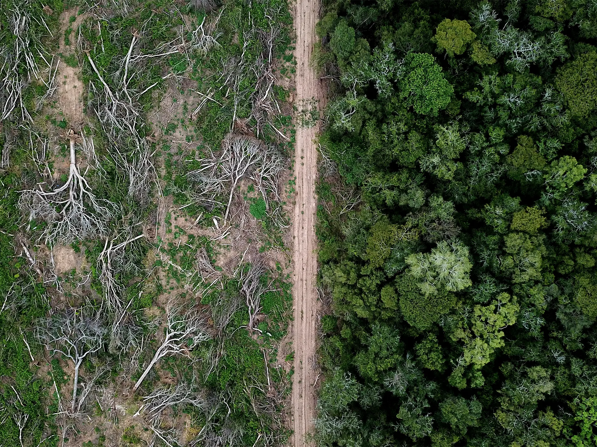
Optical Imagery
Natural-colour intelligence for clear, detailed analysis
Access very high-resolution multispectral imagery ideal for environmental monitoring, mapping, infrastructure planning and change detection.
Use for: feature identification, vegetation health, land-use mapping, modelling.
Access data from over 40 satellite constellations, including Pléiades, Pléiades Neo, WorldView, GeoEye, SkySat, PlanetScope, BlackSky, Sentinel-2 and Landsat.
Basemaps, Elevation & Reference Layers
The foundation for accurate mapping and modelling
We supply high-quality basemaps, terrain models and GIS-ready layers that add spatial context to your analysis.
Use for: planning, simulation, terrain understanding, line-of-sight modelling, navigation.
Products include:
- Optical and SAR basemaps
- Digital Elevation Models (DEM), DSM, DTM
- Point clouds, contours and custom terrain datasets
- Street networks, building footprints, administrative boundaries
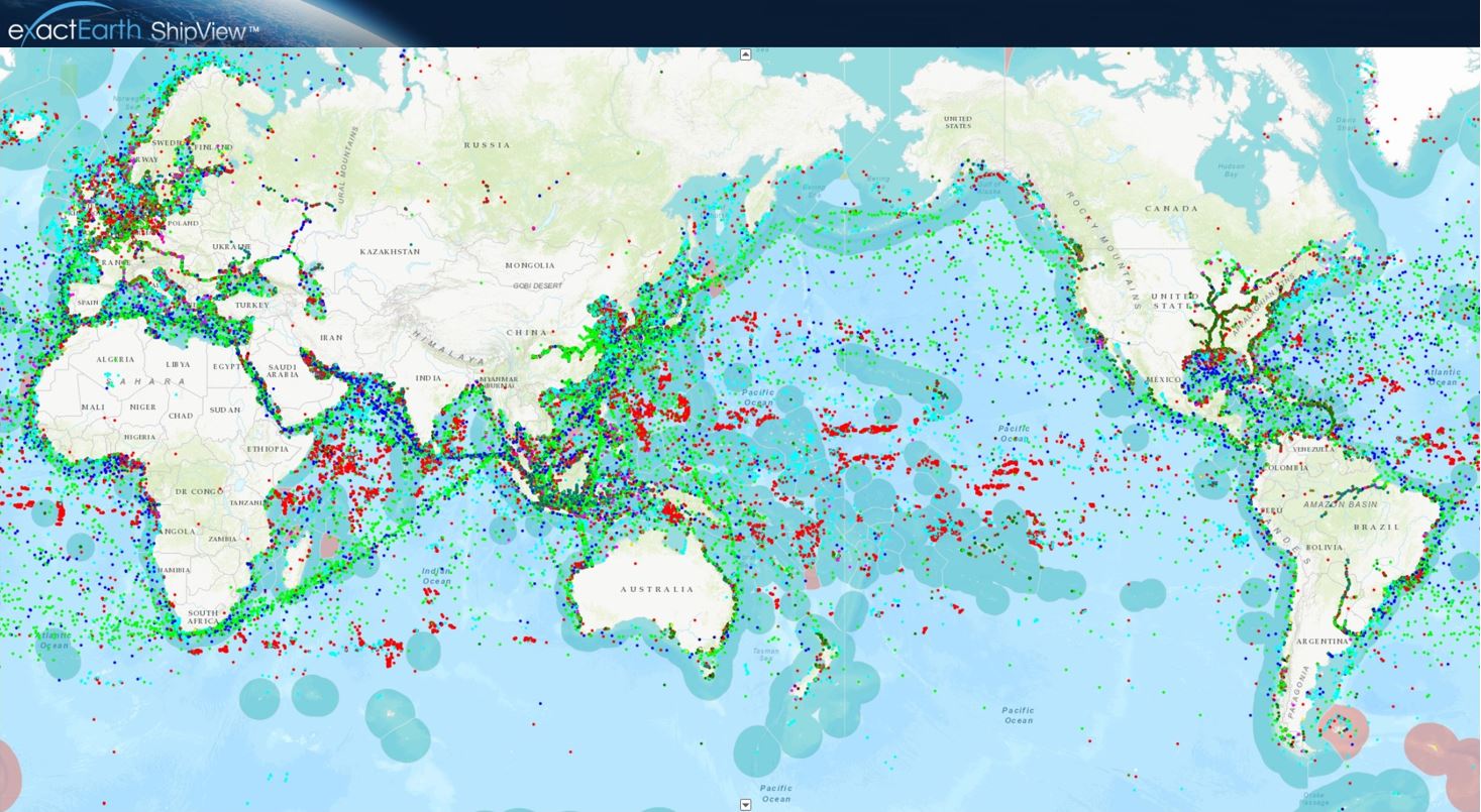
SAR Imagery
All-weather, day/night monitoring
Synthetic Aperture Radar penetrates cloud, smoke and darkness, delivering reliable insight when optical imagery cannot.
Use for: vessel detection, flood mapping, land deformation, persistent monitoring.
Access data from leading SAR constellations, including Capella Space, TerraSAR-X, TanDEM-X and Sentinel-1.
Advanced Image & Data Services
Transform raw data into actionable intelligence
Our analysts specialise in processing, analysing and fusing multi-sensor datasets including optical, SAR, multispectral, LiDAR, hyperspectral, thermal, AIS and OSINT.
We support:
- Pansharpening and orthorectification
- Mosaicking and colour-balancing
- Change detection and temporal analysis
- Environmental and infrastructure monitoring
- Oil spill and ship detection
- Feature extraction and classification
- Intelligence reporting and operational assessments
- Bespoke mapping and modelling products
Case Studies

Australian Space Awards Nominations
The team at Geospatial Intelligence Pty Ltd are pleased to share the news that we have named as finalists in 5 categories for the Space...Continue reading→
Tracking COVID 19 from space
Could you track where you have been in the past 17 days? In light of the Covid-19 pandemic and the heightened interest in cruise liners,...Continue reading→
Need the right imagery for your project? Our specialists are here to help
Get fast access to the right data, from the right sensor, at the right time