Automatic Identification System (AIS)
Real-time maritime intelligence from space
Track, monitor and analyse vessel movements with comprehensive real-time and historic AIS data. Geospatial Intelligence delivers AIS services across Australia and New Zealand through our partnership with Kpler, a global leader in maritime intelligence. We integrate AIS with satellite imagery, analytics and multi-sensor intelligence to provide a clear, continuous picture of vessel activity worldwide.

Kpler AIS
Geospatial Intelligence enhances Kpler data with fusion workflows, imagery intelligence and domain expertise.
-
Rapid revisit rates and low-latency global coverage
-
High message detection, even in congested areas
-
Real-time and historical vessel data
-
Support for advanced maritime analytics and operational decision-making

Why satellite AIS matters
AIS enables organisations to:
- Monitor 100% of the global commercial fleet in near real time
- Access 13+ years of historic vessel movement data
- Benefit from 13,000+ AIS receivers across land, sea and space
- Receive data with sub-minute latency
- Detect anomalies, dark activity and suspicious behaviour
- Support maritime domain awareness, border security, search & rescue and environmental protection
- Combine AIS with imagery, OSINT and other data feeds for richer insight
Satellite AIS extends visibility far beyond terrestrial tracking systems, providing persistent coverage across oceans, remote regions and high-traffic maritime zones.
Use cases
-
Maritime Domain Awareness (MDA)
-
Illegal, Unreported & Unregulated (IUU) fishing detection
-
Environmental monitoring and spill response
-
Border security and coastal surveillance
-
Vessel risk and compliance
-
Fleet tracking and logistics
-
Search & Rescue (SAR) operations
Case Studies
Celebrating 15 Years of Supporting Defence, Government and Industry to Make Intelligent Decisions
15 years ago, Geospatial Intelligence Pty Ltd founder and CEO, Rob Coorey, had a vision to “Assist clients to collect, analyse and interpret, location-based information...Continue reading→
Australian Space Company Delivers
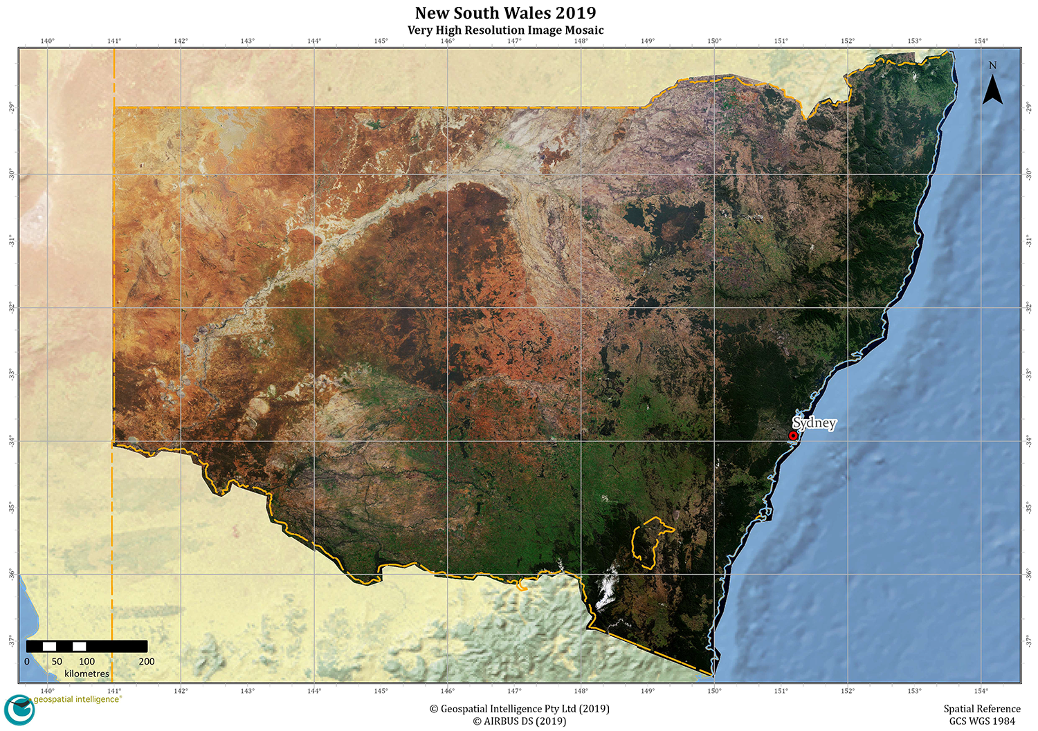
Australian space company, Geospatial Intelligence, has entered into a worldleading partnership, delivering up to date state-wide, very high-resolution satellite image mosaics to the New South...Continue reading→
Enhance AIS with multi-sensor intelligence
We combine AIS with:
- SAR imagery for vessel detection in low visibility
- Optical imagery for visual confirmation
- OSINT for behavioural and contextual analysis
- Custom alerts, dashboards and reporting
This fusion delivers stronger situational awareness, higher accuracy and faster operational response.

Strengthen your maritime awareness with trusted AIS intelligence
Get expert guidance on the right AIS data, integration approach and analytical workflows for your operational needs
