Automatic Dependent Surveillance-Broadcast (ADS-B)
Real-time aircraft tracking and air-domain intelligence
Geospatial Intelligence provides access to global ADS-B data to support aviation monitoring, security operations, intelligence analysis and situational awareness. By integrating ADS-B with satellite imagery, AIS, OSINT and analytics, we deliver a complete picture of air and maritime activity – anywhere on the planet.
ADS-B enables continuous tracking of aircraft identity, position, altitude, speed and heading. Satellite-based ADS-B extends coverage far beyond terrestrial receivers, providing persistent visibility over oceans, remote regions and high-risk air corridors.

Satellite ADS-B coverage
We integrate ADS-B feeds into dashboards, analytical tools and intelligence workflows to support both operational monitoring and long-term pattern analysis
-
Visibility
Global aircraft visibility, including remote and oceanic regions
-
Flight Data
Low-latency real-time and historical flight data
-
Coverage
Coverage beyond the reach of ground-based radar
-
Tracking
Reliable tracking for commercial, general and selected government aviation
Case Studies
World Space Week Day 2 – Carbon Accounting
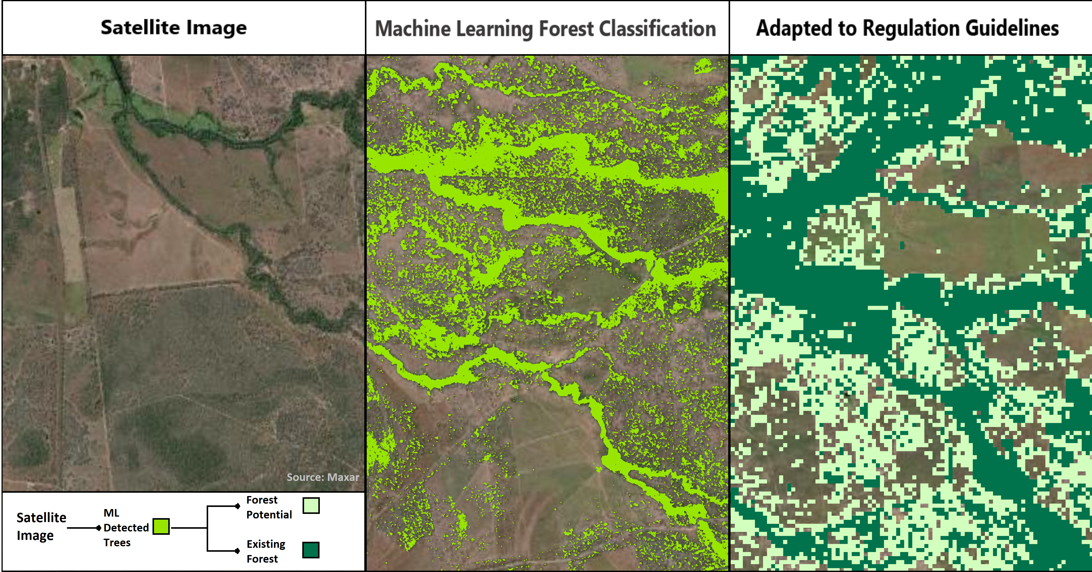
For Day 2 of World Space Week, we will be investigating how GI contributes to Carbon Accounting here in Australia. Several of the UN sustainable...Continue reading→
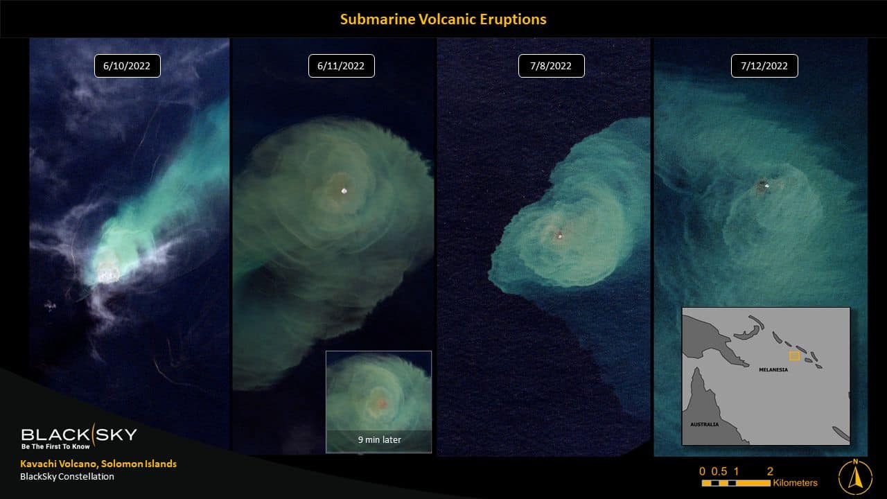
Supplier-in-Focus (October): BlackSky
Welcome to the second instalment of our ‘Partner-in-Focus’ post! Each month, GI will be highlighting one of our Partners over our social media channels. Our...Continue reading→

Why ADS-B matters
ADS-B allows organisations to:
- Monitor global aircraft movements in near real time
- Enhance air-domain awareness and operational planning
- Detect unusual flight behaviour or unauthorised activity
- Support border protection and security operations
- Improve emergency response and search-and-rescue coordination
- Combine air-tracking data with imagery and OSINT for deeper intelligence
Enhance air-domain awareness with trusted ADS-B intelligence
Get expert guidance on aircraft tracking data, coverage options and how ADS-B can be integrated with imagery, maritime data and open-source intelligence to support your mission
