
From raw satellite imagery to a GIS-ready water layer in 16 seconds
Remote sensing workflows often contain tasks that are well understood, but still require specialist knowledge and analyst time to perform.
Water masking is a good example.
Identifying water in satellite imagery is not a new problem. Experienced remote-sensing analysts have several established ways of approaching it. But producing a useful result can still involve image preparation, selecting and configuring an appropriate method, processing the imagery, reviewing the result and preparing the output for use in GIS.
With Osprey, GeoAI can take care of more of that routine processing.
The challenge
For many organisations, the value of satellite imagery lies in what happens after the initial image processing.
Analysts may want to measure land area, delineate coastlines, identify infrastructure, analyse change or combine imagery-derived information with existing GIS data.
Before that analysis can begin, however, imagery often needs to be converted into useful information layers.
These preprocessing tasks can consume the time of experienced remote-sensing analysts. They can also create a barrier for GIS professionals who are comfortable working with spatial data but may not have specialist experience processing satellite imagery.
The opportunity for GeoAI is to reduce that barrier without removing the analyst from the workflow.
The Osprey workflow
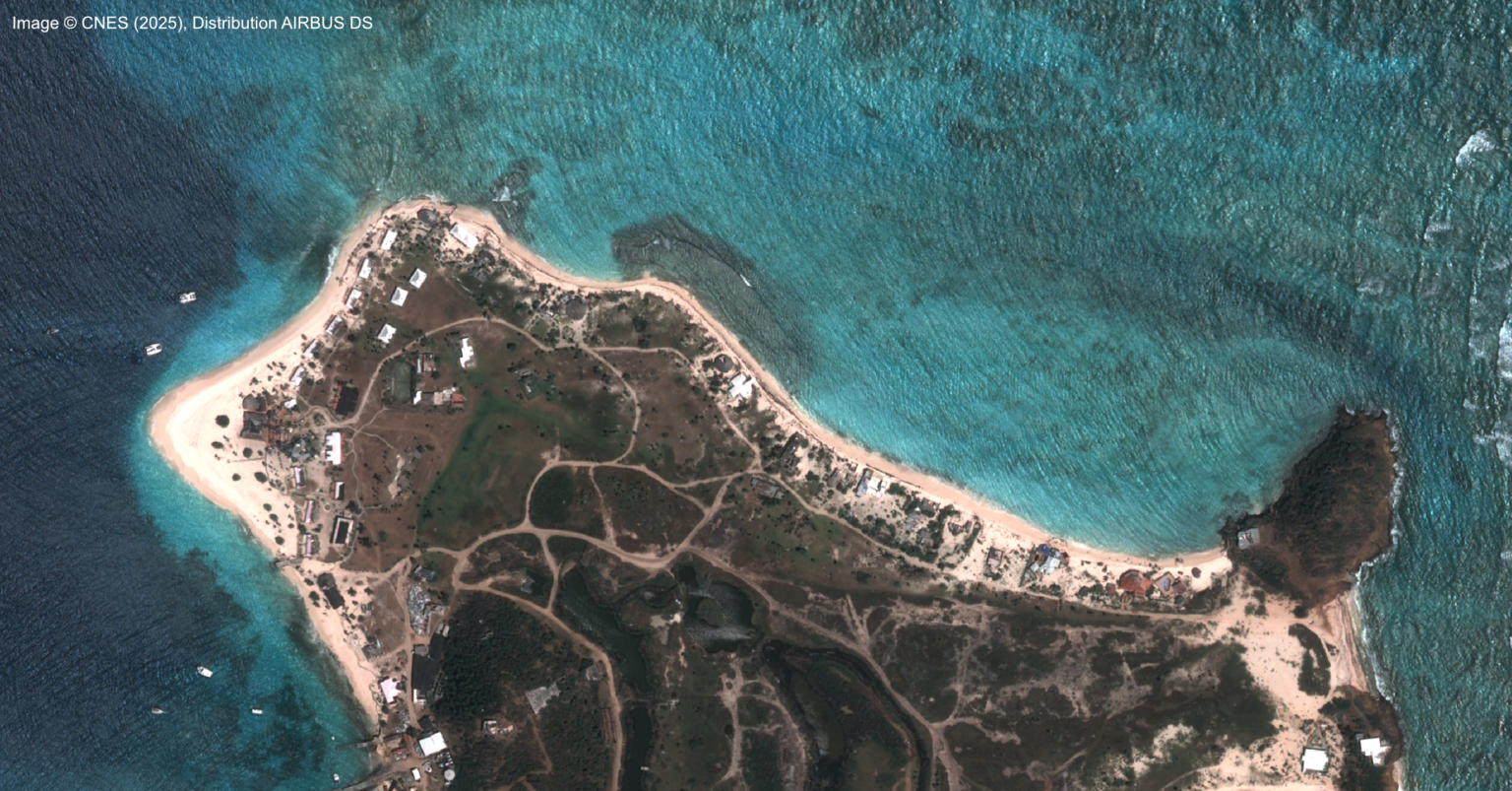
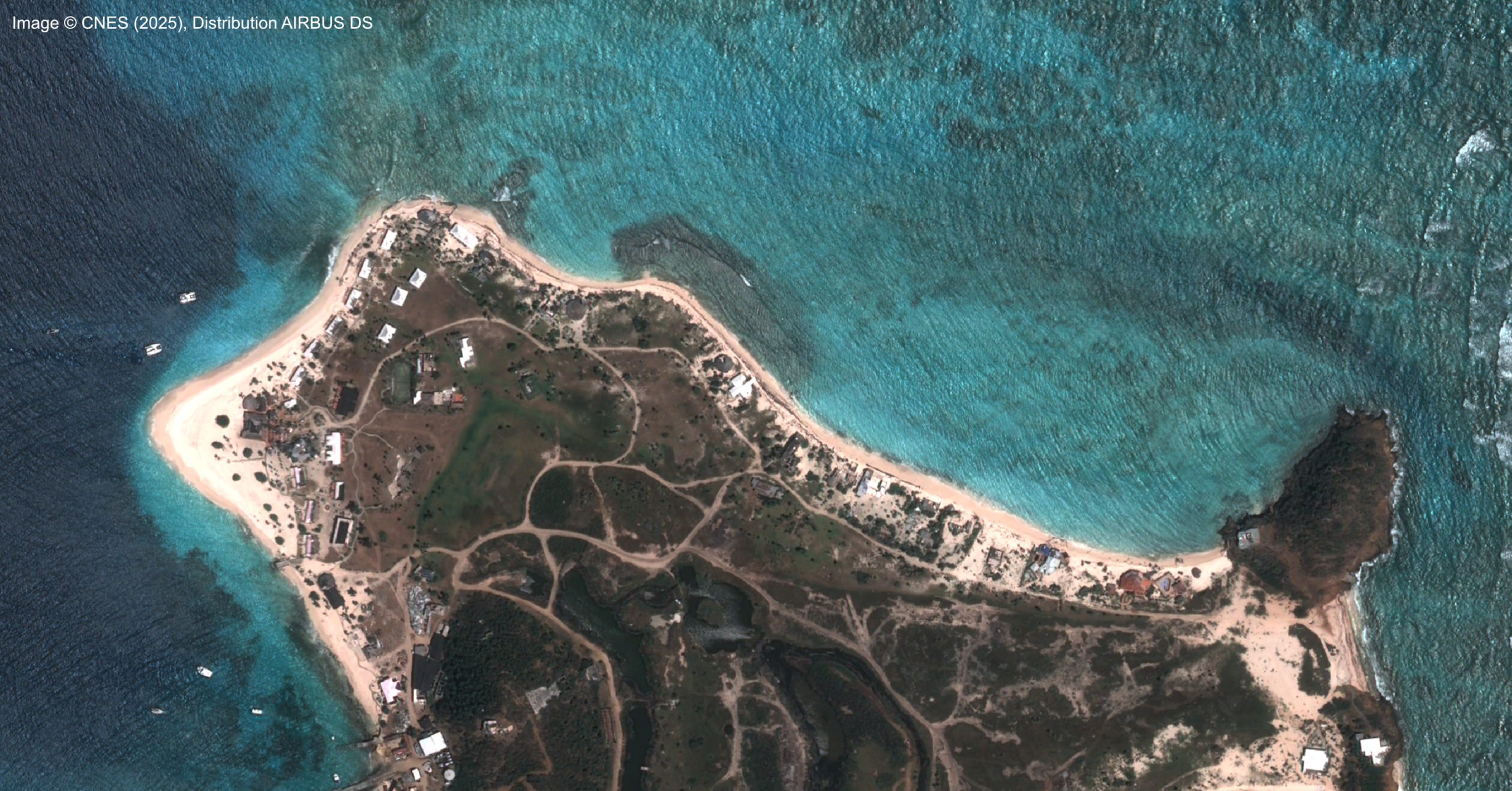
For this example, we started with raw 16-bit, 4-band Airbus Pléiades imagery, as supplied by the imagery provider.
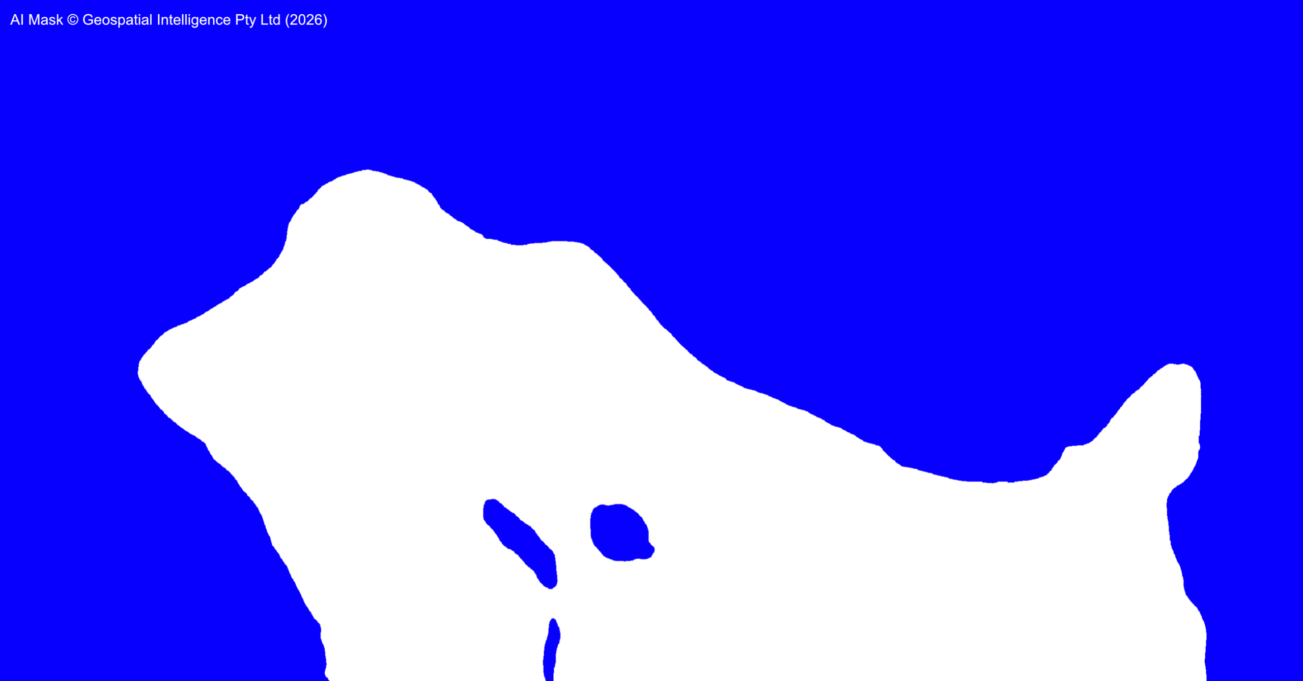
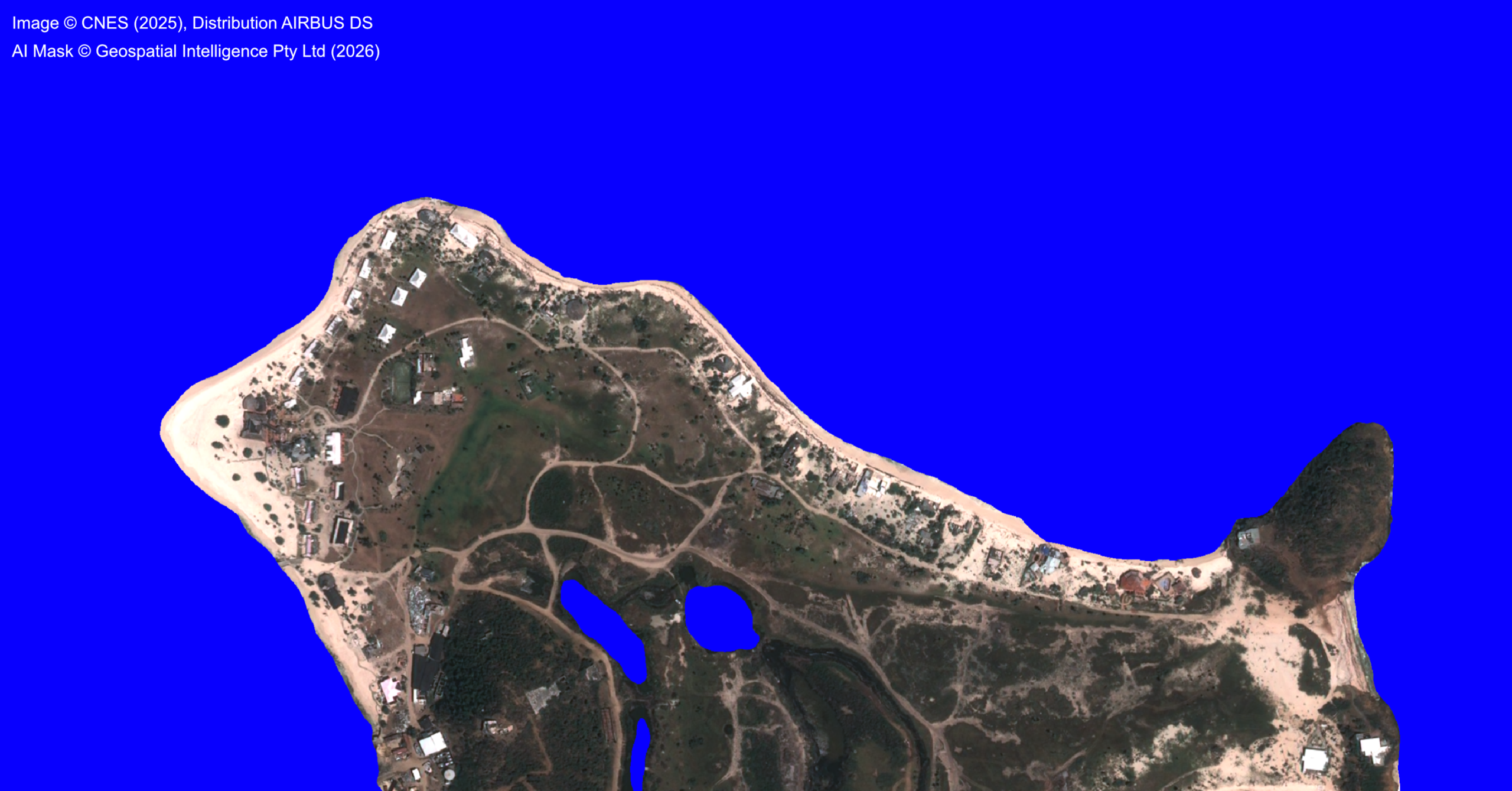
Rather than manually preparing the image and developing a water classification workflow, the imagery was processed in Osprey using a deep-learning water segmentation capability.
The water mask was produced in 16 seconds.
The result was generated as a GIS-ready vector layer, allowing the identified water areas to be used directly in subsequent spatial workflows. Where raster data is more appropriate, the output can also be produced in raster form.
That distinction is important.
The objective isn't simply to produce an AI visualisation. It's to turn imagery into usable geospatial information that can become part of a broader GIS or remote-sensing workflow.
Outcome
The example demonstrates a relatively simple application of GeoAI, and deliberately so.
The imagery includes ocean, shallow coastal water and small inland water bodies. As the accompanying images show, Osprey's segmentation provides a useful separation between water and land and converts that result into a spatial data product.
The result is not presented as perfect.
There will continue to be situations where analyst review, refinement or a different processing approach is appropriate. Environmental conditions, image characteristics and the intended use of the output all matter.
The benefit is that the analyst doesn't necessarily have to begin from scratch.
Augmenting expertise, rather than replacing it
We see this as one of the more practical roles for GeoAI.
For experienced remote-sensing professionals, Osprey can automate some of the repetitive, boilerplate processing and provide a rapid first result. The analyst can then spend more time on validation, interpretation and the difficult cases where specialist knowledge has the greatest value.
For GIS professionals without specialist remote-sensing experience, GeoAI can make imagery-derived information more accessible by reducing the expertise required for every individual processing step.
That doesn't remove the need to understand the data or assess whether a result is appropriate for its intended use.
It changes where people spend their time.
From imagery to information
The interesting thing about this example isn't that artificial intelligence can identify water. There are already established approaches for doing that.
The interesting part is the workflow:
Raw supplier imagery → Osprey → GeoAI processing → GIS-ready spatial data
In this example, that transition took 16 seconds.
That's the role we see for Osprey: bringing imagery, GeoAI and GIS workflows closer together so that useful geospatial products can be produced with less manual processing, while keeping people and domain expertise firmly in the loop.