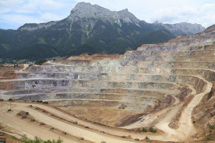
Solutions & Data

Integrated geospatial solutions for clarity, insight and confident decision-making

Geospatial Intelligence delivers high-quality data, advanced analytics and tailored solutions that help organisations understand context, monitor change and solve complex problems. Whether sourcing best-in-class products or developing bespoke workflows, we ensure you have the geospatial intelligence needed to act with confidence.

A patterned, terraced agricultural landscape with rows of lush green crops forming geometric contours.

Our products

Best-in-class data sources for mission-ready intelligence

High-Resolution Satellite Imagery

Access industry-leading optical and radar imagery from the world’s major satellite imagery providers.

We source new tasked collections or draw from extensive global archives to ensure you get the right sensor, right resolution and right moment for your mission.

Automatic Identification System (AIS)

We provide satellite Automatic Identification System (AIS) data through our partnership with Kpler, supporting real-time and historical vessel tracking.

AIS can be combined with imagery, OSINT and analytics to significantly enhance maritime domain awareness.

Automatic Dependent Surveillance-Broadcast (ADS-B)

We provide satellite Automatic Dependent Surveillance-Broadcast (ADS-B) data through our partnership with Aireon, enhanced air traffic surveillance, innovation and analytics.

ADS-B can be combined with other data sources to enhance air domain awareness.

Our services

Advanced Image & Data Services

Transform raw data into actionable intelligence.

Our analysts specialise in processing and analysing high-resolution imagery across optical, radar, multispectral, LiDAR, hyperspectral and thermal datasets.

We integrate imagery with AIS, OSINT and additional feeds to deliver advanced, value-added geospatial products.

Support & Training

We provide training across imagery analysis, geospatial systems, data management and analytical workflows from introductory through advanced tradecraft.

Our programs strengthen internal capability and accelerate operational proficiency.

Consulting & Advisory

Our consultants help organisations maximise the value of their geospatial data and systems.
We support:

  • Geospatial data management
  • Systems architecture and configuration
  • Business, systems and process analysis
  • GIS workflows and optimisation
  • Imagery analysis
  • Data analytics and business intelligence
  • Program, project and change management
  • User research and design
  • Sensitive and secure project environments

As an Esri Business Partner, we offer expert guidance and support across the full Esri ecosystem.

Our platforms

AI-driven analytics and mission-ready platforms like Osprey and Mercury, designed to support enterprise systems and operational needs

Specialist support across the full Esri ecosystem

We work across the complete suite of Esri technologies to help organisations design, deploy, customise and optimise their GIS environments.
Tools we support include:

  • ArcGIS Pro
  • ArcGIS Online
  • ArcGIS Enterprise
  • ArcGIS for Developers
  • ArcGIS Applications

Our team provides installation, configuration, custom development, training and ongoing support.

Aerial view showing a stark boundary between dry, barren land and dense green forest, with branching dirt roads cutting through the vegetation.

Case Studies

Aerial view of evenly spaced trees planted in diagonal rows across cultivated farmland.

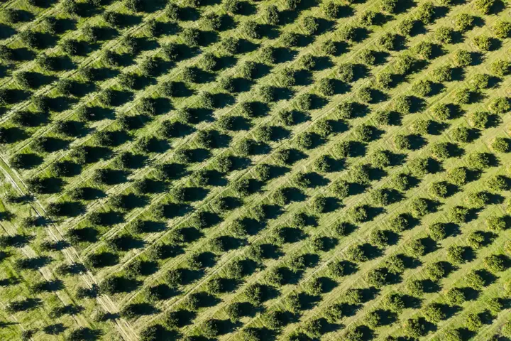
Orchard Management Using Satellite-Based Tree Health Detection

Geospatial Intelligence conducted a remote sensing assessment for an Australian orchard to identify unhealthy or damaged trees at scale. Using satellite imagery and NDVI analysis, the project produced a detailed tree health classification map, accuracy report, and geospatial outputs for operational use. The insights allow the orchard to detect issues earlier, improve decision making, and support long term productivity and orchard health.Continue reading

Aerial view of a container ship traveling across deep blue water with stacked red and blue shipping containers on deck.

Why work with us

We provide access to the world’s leading satellite imagery providers, supported by direct tasking for rapid data collection and expert analysts with deep geospatial experience. We combine advanced processing and proven analytical tradecraft to deliver accurate, decision-ready intelligence.

Trusted by defence, government, emergency services and commercial clients, we support operations worldwide – from maritime surveillance across the Pacific, to bushfire analytics in Western Australia, to AIS services delivered to Australian federal agencies.

From single-image requests to enterprise-scale data pipelines, we deliver flexible solutions designed around real operational needs.

Let us help you find the right geospatial data and solutions for your mission

From data sourcing to full operational solutions, we’ll help you get it right

Scroll to Top