About
Australia’s maritime region has rich marine biodiversity and strong ecological value that increasingly faces environmental stress due to recurring oil contamination events. These spills threaten not only wildlife but also the health of coastal ecosystems that support local economies, tourism, and broader marine food webs. Seeking to understand the scale of the threat, evaluate ecological vulnerability, and develop strategies to mitigate long-term damage, The Australian Maritime Safety Authority (AMSA) engaged Geospatial Intelligence to monitor the Great Barrier Reef, Torres Strait and North West Shelf regions using Synthetic Aperture Radar (SAR) satellite technology.
The Challenge
-
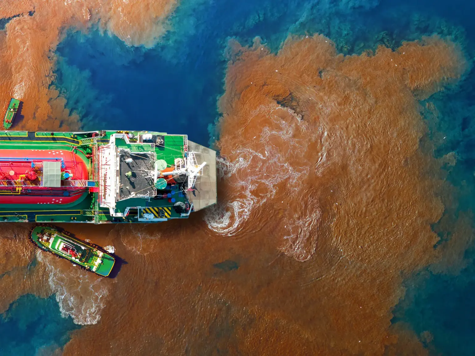
ESCALATING OIL CONTAMINATION
Oil spills introduce toxic pollutants that accumulate in marine waters and sediments, posing severe risks to fish, seabirds, marine mammals, and coastal ecosystems.
-
HABITAT DISRUPTION
Ecologically sensitive environments such as; coral ecosystems, mangroves, estuaries, and nearshore nurseries experience longterm degradation following exposure to petroleum compounds. These disruptions reduce ecological resilience and affect species’ survival rates.
-
LIMITED RESPONSE COORDINATION
Effective spill mitigation requires robust data sharing, coordinated communication, and timely response. Without integrated geospatial tools, responding agencies face delays that worsen environmental outcomes.
Project Overview
Through this engagement, AMSA gained access to advanced geospatial tools and spill-response modelling, including:
- Shared real-time situational reporting showing spill extent and severity.
- Integration of spill observations, supporting rapid validation and decision-making.
- Ongoing stakeholder reporting, ensuring the regulatory agencies receive consistently regular updates.
- Ecological vulnerability mapping, highlighting sensitive habitat zones at highest risk.
Outcome
The program produced a strategic decision-support framework to limit damage during spill events and guide long-term marine-protection policies:
- Improved interagency coordination and faster operational response.
- Enhanced understanding of habitat vulnerability, allowing targeted restoration planning.
- Better risk-management strategies, protecting marine ecosystems from cumulative spill impacts.
- Strengthened conservation planning, ensuring long-term resilience of marine environments.