SAR Satellite Imagery
Reliable intelligence in any weather, any time
Synthetic Aperture Radar (SAR) imagery provides consistent, high-resolution intelligence regardless of cloud, smoke, darkness or adverse weather. This makes SAR essential for defence, maritime, environmental and emergency operations where uninterrupted visibility is critical.

What SAR imagery delivers
SAR is ideal for persistent monitoring and applications where optical imagery is limited or unavailable
-
Maritime Surveillance
Vessel detection, dark targets, anomaly detection
-
Flood Mapping & Environmental Monitoring
Water extent, soil moisture, land cover change
-
Deformation & Movement Monitoring (InSAR)
Subsidence, infrastructure stability, landslides
-
All-Weather Monitoring
Cloud-prone, remote or inaccessible regions
-
Rapid, Time-critical Intelligence
Day/Night Operations
When SAR Is the Best Choice
Choose SAR when:
- You require coverage during cloud, storms, smoke, night-time or winter
- You need to track vessels far offshore
- You are assessing flood impacts or standing water
- You require precise measurement of ground movement
- You need highly reliable monitoring at regular intervals
If visual interpretation or colour-based classification is required, optical imagery may be a better fit.

SAR Constellations We Provide
Through our partners, we supply both new tasked collections and extensive archive coverage from leading radar systems:
-
Capella
Capella operates a global, all‑weather X-band SAR constellation delivering very‑high‑resolution (down to 0.25 m) radar imagery with rapid, automated tasking and persistent coverage for mission‑critical monitoring.
-
Sentinel – 1A/1B/1C
Sentinel‑1 is ESA’s all‑weather, day‑and‑night C‑band radar mission delivering frequent, reliable imagery for land, ocean, ice and emergency monitoring through a constellation of identical satellites.
-
TerraSAR-X and TanDEM-X (0.25m)
TerraSAR‑X is a German X‑band SAR satellite delivering sub‑metre wide‑area, all‑weather InSAR compatible imagery with outstanding geometric accuracy as part of the Airbus radar constellation.
-
PAZ
PAZ a Spanish X‑band SAR satellite, delivering high‑resolution all‑weather imagery and operating in constellation with TerraSAR‑X and TanDEM‑X to reduce revisit times.
-
Synspective Strix
StriX is Synspective’s constellation of 100 kg class X band SAR satellites, delivering 1–3 m resolution, all weather imaging.
Case Studies
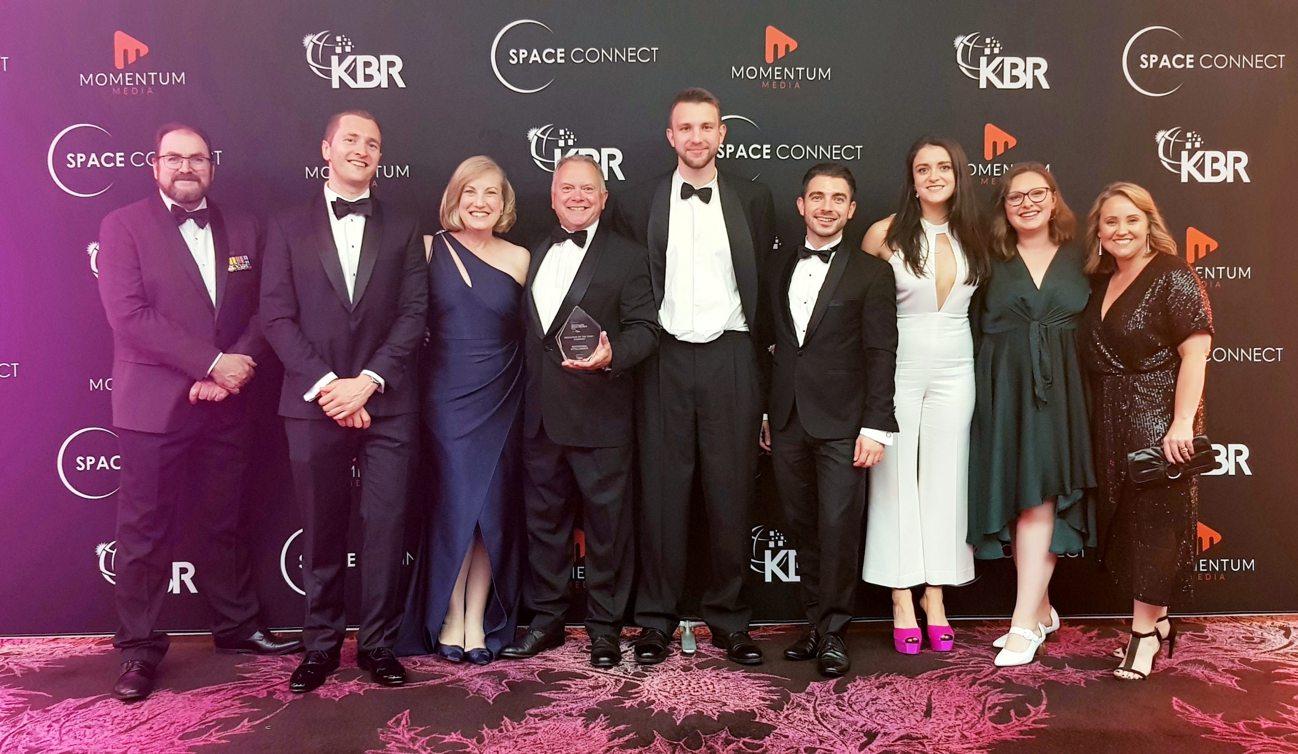
GI awarded ‘Innovator of the Year – Company’ at the Australian Space Awards
The GI team attended the COVID-safe inaugural Australian Space Awards in Sydney. We were thrilled to be recognised by the industry, winning the award for...Continue reading→
GI were announced Award Winner’s for the Gravity 02
GI were announced Award Winner's for the Gravity 02 Awards last night. We are excited to continue working with The Commission on Excellence and Innovation in Health (CEIH) and the Gravity Challenge team to further progress our solution to the challenge "The Next Pandemic: Failure is not an option"Continue reading→

Enhance your SAR data
Our specialists process and analyse radar datasets to transform them into actionable intelligence:
- Flood mapping & water delineation
- InSAR deformation analysis (infrastructure, mining, subsidence)
- Vessel detection and maritime domain awareness
- Change detection (activity, construction, disturbance)
- Surface roughness, land cover and continuity analysis
- Multi-sensor fusion with optical imagery, AIS, OSINT and more
Get reliable intelligence in any weather, day or night
Get expert guidance on the right imagery for your project
