Optical Satellite Imagery
Natural-colour intelligence for clear, detailed visual analysis
Optical satellite imagery provides highly detailed, photo-like views of the Earth’s surface, enabling accurate mapping, monitoring and assessment across defence, government and commercial applications. With access to the world’s leading optical constellations, we deliver the right resolution, sensor and collection strategy for any mission.

What optical imagery delivers
Optical imagery captures reflected sunlight across visible and infrared wavelengths, making it ideal for applications that require intuitive interpretation and multispectral analysis. Use optical imagery for:
-
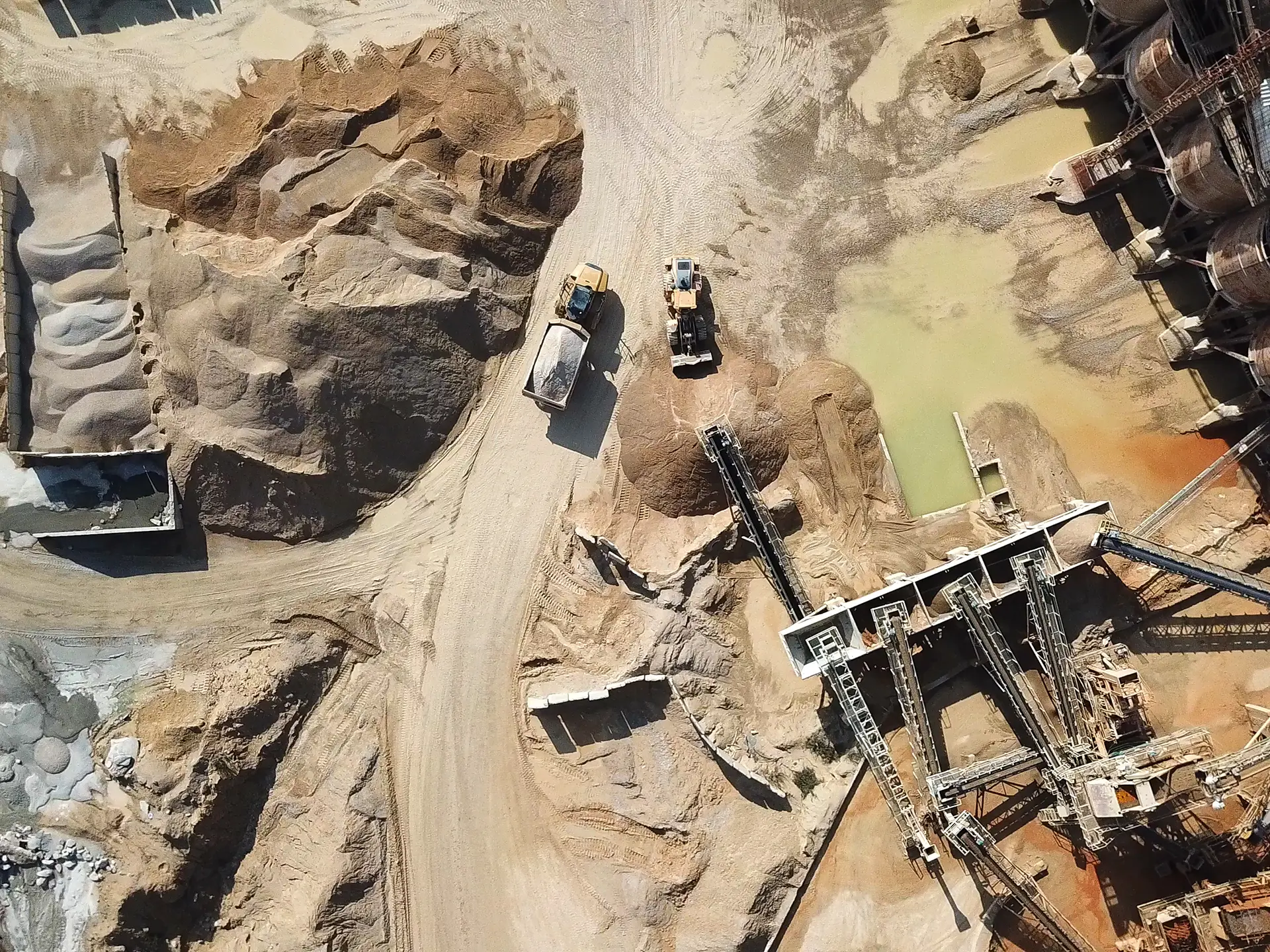
Feature Identification
Infrastructure, vegetation, assets, terrain
-
Urban & Infrastructure Planning
Growth monitoring, boundary mapping
-
Environmental Assessment
Vegetation health, water quality, habitat analysis
-
Change Detection
Construction, land clearing, environmental impact
-
Basemap Creation
Visually consistent foundation layers for GIS

When optical is the best choice
Optical imagery is preferred when:
- You need natural-colour or multispectral views of the environment
- Ground features must be classified or visually interpreted
- You are monitoring seasonal or long-term landscape change
- Cloud-free data is available or predictable
- You require analysis using NDVI, SWIR or spectral indices
If your area of interest is frequently cloudy or you require night-time or all-weather monitoring, SAR may be more suitable.
Optical constellations we provide
We source new tasked imagery and global archive content from leading providers
-
Blacksky Global
BlackSky operates a rapid revisit constellation of high resolution Earth observation microsatellites that deliver 1 metre class, near real time imagery across the globe.
-
Deimos-1
Deimos‑1 is a Spanish Earth‑observation satellite built by SSTL, equipped with a 22‑metre multispectral imaging instrument and a wide swath exceeding 600 kilometres for efficient large‑area coverage.
-
UK-DMC-2 Constellation
UK‑DMC‑2 is a British Earth‑observation satellite built by SSTL, carrying a 22‑metre multispectral imaging instrument with a wide swath of more than 600 kilometres for efficient, large‑area environmental monitoring.
-
GeoEye-1
GeoEye‑1 is a high‑resolution Earth‑observation satellite operated by Vantor, capable of capturing 41‑centimetre panchromatic and 1.65‑metre multispectral imagery from a 681‑kilometre sun‑synchronous orbit.
-
IKONOS
IKONOS was a high resolution Earth observation satellite, capturing 0.82 metre panchromatic and 3.2 metre multispectral imagery from a 681 kilometre sun synchronous orbit.
-
Kompsat-3A
KOMPSAT‑3A a South Korean high‑resolution EO satellite capturing 55 cm panchromatic, 2.2 m multispectral imagery to support applications ranging from urban planning to environmental and disaster monitoring.
-
Kompsat-3
KOMPSAT‑3 a South Korean high‑resolution EO satellite capturing 70 cm panchromatic and 2.8 m multispectral imagery across visible and near‑infrared bands to support precise mapping, land monitoring, and environmental applications.
-
Landsat
Landsat is NASA and the USGS’s long‑running Earth‑observation program, providing the world’s longest continuous land‑imaging record since 1972 to support global environmental monitoring, resource management and long‑term change analysis.
-
NewSat Mark IV
NewSat Mk IV is Satellogic’s sub‑metre multispectral Earth‑observation satellite, delivering 99‑cm native resolution imagery across a 5‑km swath with up to seven daily revisits for reliable, high‑frequency monitoring
-
NewSat Mark V
NewSat Mark V is Satellogic’s fifth generation optical satellite, delivering native 70 cm resolution, a wider 6.5 km swath, and boosted collection capacity of 350,000 km² per day for sharper, more efficient large area monitoring.
-
PlanetScope Constellation
PlanetScope is a global Earth‑observation constellation of 430+ Dove and SuperDove CubeSats that capture daily, multispectral imagery of all landmasses at 3–4‑metre resolution, enabling consistent, high‑frequency monitoring at planetary scale.
-
Pléiades
Pléiades is a very‑high‑resolution Earth‑observation constellation of two agile satellites capable of capturing 50‑centimetre colour imagery with rapid tasking and global daily revisit access for both civil and defence applications.
-
Pleiades Neo
Pléiades Neo is Airbus’s latest very high resolution optical constellation, featuring twin 30 cm class satellites that deliver highly accurate, reactive, and large capacity imagery with rapid tasking and daily global revisit capability.
-
QuickBird
QuickBird was a high‑resolution Earth‑imaging satellite delivering 61‑centimetre panchromatic and 2.44‑metre multispectral imagery across a 16.8‑kilometre swath, supporting detailed mapping and analysis for a wide range of commercial and government applications.
-
Sentinel-2A/2B
Sentinel‑2 is a ESA wide‑swath, high‑resolution multispectral mission using a constellation of identically configured satellites to capture the global landmass with 13‑band imagery at 10–60 m resolution every 5 days, supporting detailed monitoring of land, vegetation, waterways and coastal environments.
-
SkySat Constellation
SkySat is Planet’s high‑resolution imaging constellation, capturing 50‑centimetre‑class panchromatic and 4‑band multispectral imagery with agile tasking and revisit rates of up to 10 times per day for precise, on‑demand monitoring anywhere on Earth.
-
SPOT 6 and 7
SPOT is Airbus’s broad‑coverage Earth‑observation constellation delivering 1.5‑metre panchromatic and 6‑metre multispectral imagery across 60‑kilometre swaths, enabling fast, reliable country‑scale mapping and monitoring with daily revisit capability.
-
Worldview-1
WorldView‑1 is a high‑agility, 50cm resolution panchromatic imaging satellite capable of collecting over a million square kilometres per day, offering rapid revisit times and precise geolocation for detailed mapping and analysis.
-
Worldview-2
WorldView‑2 is a high‑resolution imaging satellite offering 46‑centimetre panchromatic and 1.85‑metre, 8‑band multispectral imagery, delivering rapid ~1.1‑day revisits and up to one million square kilometres of collection per day for detailed, analytics‑ready Earth observation.
-
Worldview-3
WorldView‑3 is a super‑spectral, high‑resolution imaging satellite offering 31‑centimetre panchromatic, 1.24‑metre multispectral, and 3.7‑metre SWIR data—plus 12 atmospheric CAVIS bands—enabling rapid (<1‑day) revisits and up to 680,000 km² of daily collection for precise, analytics‑ready Earth observation.
-
WorldView Legion
WorldView Legion is Vantor’s latest six‑satellite constellation delivering 30 cm‑class panchromatic and eight‑band multispectral imagery with up to 15 revisits per day.
Case Studies

Geospatial Intelligence Pty Ltd Included in 2018 Australian Military Sales Catalogue
Tuesday 20 March 2018 Today, the Hon Christopher Pyne MP, Minister for Defence Industry, launched the 2018 Australian Military Sales Catalogue at Parliament House. Geospatial...Continue reading→

Geospatial Intelligence Proud to Support Sir John Monash Centre
Australian Prime Minister, Hon Malcolm Turnbull, admires the digital displays at the new Sir John Monash Centre in Villers-Bretoneux, including a topographic map of the...Continue reading→
Enhance your optical data
Our analysts transform raw imagery into decision-ready products, including:
- Image correction, mosaicking and enhancement
- Feature extraction and land-use classification
- Vegetation health, burn severity and environmental indicators
- Change analysis and temporal monitoring
- Custom mapping and intelligence reporting
Optical data can also be fused with SAR, AIS, ADS-B, OSINT and other datasets for advanced multi-sensor intelligence products.
Ready to order optical imagery?
Our team will source the right sensor and resolution for your needs