Geospatial Software Solutions
Deploy, integrate and optimise the platforms that power geospatial intelligence
Geospatial Intelligence helps organisations build modern, scalable and mission-ready geospatial environments. We work across leading commercial and open-source platforms including Esri, QGIS, Geoserver, Luciad, AWS and Azure to design, configure and operationalise systems that support real-time analysis, imagery exploitation, enterprise mapping and decision-support workflows.
Our specialists combine deep software engineering experience with geospatial, remote sensing and intelligence tradecraft, ensuring every platform we deliver is robust, secure and operationally effective.

What we deliver
We support the full lifecycle of geospatial software from selection and integration to optimisation and ongoing support
-
Deployment & Integration
Setting up geospatial platforms, cloud environments and analytical toolkits that align with your organisation’s workflows, data structures and operational requirements.
-
Custom Configuration
Enhancing out-of-the-box software with tailored extensions, scripts, tools and dashboards designed around your mission or operational needs.
-
Capability Development
Helping teams build internal expertise through training, advisory services and technical guidance.
Platforms & technologies
We help organisations integrate these systems into existing infrastructure and analytics environments
Esri Ecosystem
- ArcGIS Pro
- ArcGIS Enterprise
- ArcGIS Online
- ArcGIS SDKs and developer tools
- Custom extensions and integrations
Open-Source & Enterprise Platforms
- QGIS
- Geoserver
- Luciad
- GDAL and geospatial libraries
- OGC standards & services
Cloud & Infrastructure
- Amazon Web Services (AWS)
- Microsoft Azure
- Hybrid and on-premise secure environments
Case Studies

Geospatial Intelligence Pty Ltd Included in 2018 Australian Military Sales Catalogue
Tuesday 20 March 2018 Today, the Hon Christopher Pyne MP, Minister for Defence Industry, launched the 2018 Australian Military Sales Catalogue at Parliament House. Geospatial...Continue reading→
Geospatial Intelligence Proud to Support Sir John Monash Centre
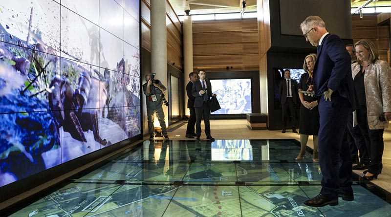
Australian Prime Minister, Hon Malcolm Turnbull, admires the digital displays at the new Sir John Monash Centre in Villers-Bretoneux, including a topographic map of the...Continue reading→
Use cases
We design and support geospatial systems used for:
-
Operational mapping and dashboards
-
Imagery exploitation and multi-sensor analytics
-
Maritime and intelligence workflows
-
Environmental and sustainability monitoring
-
Spatial modelling & simulation
-
Enterprise data management and transformation
-
Situational awareness and mission planning

Why work with us
Our team blends geospatial systems architecture with practical expertise across imagery, OSINT, AIS and multi-sensor integration. We have a strong track record delivering software in secure, mission-critical environments, and provide independent advice on the tools and configurations best suited to your needs. Whether extending, customising or modernising existing platforms, we ensure your geospatial ecosystem is robust, scalable and aligned with GI’s broader analytics and intelligence capabilities.
Build or modernise your geospatial environment with confidence.
Speak with our team about designing, integrating or optimising the platforms that support your mission.