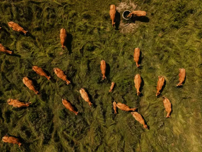
Case Study

Modelling Sea Level Rise and Storm Surge Risk for Coastal Resilience

Geospatial Intelligence conducted a sea level rise and storm surge modelling assessment for a coastal region comprising multiple cities. Using Earth Observation data, the analysis identified high-risk coastal zones and evaluated the potential impact of extreme storm surge scenarios. The insights enable local governments to strengthen emergency planning, protect critical infrastructure, and guide long-term climate adaptation strategies.

Modelling Sea Level Rise and Storm Surge Risk for Coastal Resilience Read More »

Aerial view of evenly spaced trees planted in diagonal rows across cultivated farmland.

Orchard Management Using Satellite-Based Tree Health Detection

Geospatial Intelligence conducted a remote sensing assessment for an Australian orchard to identify unhealthy or damaged trees at scale. Using satellite imagery and NDVI analysis, the project produced a detailed tree health classification map, accuracy report, and geospatial outputs for operational use. The insights allow the orchard to detect issues earlier, improve decision making, and support long term productivity and orchard health.

Orchard Management Using Satellite-Based Tree Health Detection Read More »

The Link Between Rice and Terrorism

Geospatial Intelligence analysed patterns of improvised explosive device (IED) incidents in an Asian region to uncover the drivers behind recurring spikes in violence. By combining OSINT sources with temporal analysis, the study revealed a strong link between IED activity and the agricultural cycle, particularly during months when rice is not harvested. These insights support more targeted prevention strategies, including socio-economic programs and improved planning for security and travel risk management.

The Link Between Rice and Terrorism Read More »

Reef Pattern of Activity Analysis for Marine Protected Area Compliance

Geospatial Intelligence conducted a Pattern of Activity analysis across a newly declared Marine Protected Area in northern Queensland, using optical and SAR sensors alongside AIS data to monitor vessel behaviour. The study provided authorities with clear insights into maritime activity and enabled rapid identification of vessels breaching restricted zones.

Reef Pattern of Activity Analysis for Marine Protected Area Compliance Read More »

Monitoring Dugong Populations and Seagrass Health Using UAV Remote Sensing

Geospatial Intelligence used UAV imagery and automated anomaly detection to monitor dugong populations and seagrass ecosystems off Western Australia. Processing more than 70,000 aerial scenes provided new visibility into marine habitat health and environmental change, supporting long-term conservation planning.

Monitoring Dugong Populations and Seagrass Health Using UAV Remote Sensing Read More »

Scroll to Top