Automatic Identification System (AIS)

Real-time maritime intelligence from space

Track, monitor and analyse vessel movements with comprehensive real-time and historic AIS data. Geospatial Intelligence delivers AIS services across Australia and New Zealand through our partnership with Kpler, a global leader in maritime intelligence. We integrate AIS with satellite imagery, analytics and multi-sensor intelligence to provide a clear, continuous picture of vessel activity worldwide.

Gray military vessel sailing across calm green-blue water with a small island in the distance.

Kpler AIS

Geospatial Intelligence enhances Kpler data with fusion workflows, imagery intelligence and domain expertise.

  • Rapid revisit rates and low-latency global coverage
  • High message detection, even in congested areas
  • Real-time and historical vessel data
  • Support for advanced maritime analytics and operational decision-making
Aerial view of a large vessel surrounded by a wide plume of brown, polluted water spreading into blue sea.

Why satellite AIS matters

AIS enables organisations to:

  • Monitor 100% of the global commercial fleet in near real time
  • Access 13+ years of historic vessel movement data
  • Benefit from 13,000+ AIS receivers across land, sea and space
  • Receive data with sub-minute latency
  • Detect anomalies, dark activity and suspicious behaviour
  • Support maritime domain awareness, border security, search & rescue and environmental protection
  • Combine AIS with imagery, OSINT and other data feeds for richer insight

Satellite AIS extends visibility far beyond terrestrial tracking systems, providing persistent coverage across oceans, remote regions and high-traffic maritime zones.

Use cases

  • Maritime Domain Awareness (MDA)
  • Illegal, Unreported & Unregulated (IUU) fishing detection
  • Environmental monitoring and spill response
  • Border security and coastal surveillance
  • Vessel risk and compliance
  • Fleet tracking and logistics
  • Search & Rescue (SAR) operations

Case Studies

Aerial view of evenly spaced trees planted in diagonal rows across cultivated farmland.

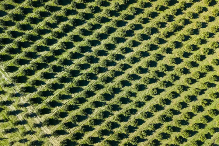
Orchard Management Using Satellite-Based Tree Health Detection

Geospatial Intelligence conducted a remote sensing assessment for an Australian orchard to identify unhealthy or damaged trees at scale. Using satellite imagery and NDVI analysis, the project produced a detailed tree health classification map, accuracy report, and geospatial outputs for operational use. The insights allow the orchard to detect issues earlier, improve decision making, and support long term productivity and orchard health.Continue reading

Modelling Sea Level Rise and Storm Surge Risk for Coastal Resilience

Geospatial Intelligence conducted a sea level rise and storm surge modelling assessment for a coastal region comprising multiple cities. Using Earth Observation data, the analysis identified high-risk coastal zones and evaluated the potential impact of extreme storm surge scenarios. The insights enable local governments to strengthen emergency planning, protect critical infrastructure, and guide long-term climate adaptation strategies.Continue reading

Enhance AIS with multi-sensor intelligence

We combine AIS with:

  • SAR imagery for vessel detection in low visibility
  • Optical imagery for visual confirmation
  • OSINT for behavioural and contextual analysis
  • Custom alerts, dashboards and reporting

This fusion delivers stronger situational awareness, higher accuracy and faster operational response.

Top-down view of a cargo ship docked beside bright yellow cranes and stacked shipping containers.

Strengthen your maritime awareness with trusted AIS intelligence

Get expert guidance on the right AIS data, integration approach and analytical workflows for your operational needs

Scroll to Top