Application Development
Custom geospatial applications built for your mission
Geospatial Intelligence designs and develops tailored software applications that bring geospatial data, imagery, analytics and machine intelligence together in practical operational workflows.
From lightweight mobile tools to enterprise-scale geospatial platforms, we build solutions that address real-world challenges across defence, government and commercial sectors.
Our development team combines deep geospatial expertise with modern engineering practices to deliver secure, scalable solutions that are ready for operational use.

What we develop
We create custom applications and system components that enhance geospatial capability, including:
-
Custom geospatial applications
Purpose-built tools that support your workflows, data sources and operational requirements designed to integrate seamlessly into your organisation.
-
AI-enhanced imagery solutions
Applications powered by automated object detection, segmentation, feature extraction and modelling for rapid analytical insight.
-
Extensions & integrations
Custom add-ins, plugins and system components for enterprise platforms including ArcGIS Pro, QGIS, Luciad, GDAL and Geoserver.
-
Secure, scalable systems
Software engineered for cloud, hybrid or on-premise environments including deployments in sensitive and secure contexts.
Case Studies

Geospatial Intelligence Pty Ltd Included in 2018 Australian Military Sales Catalogue
Tuesday 20 March 2018 Today, the Hon Christopher Pyne MP, Minister for Defence Industry, launched the 2018 Australian Military Sales Catalogue at Parliament House. Geospatial...Continue reading→
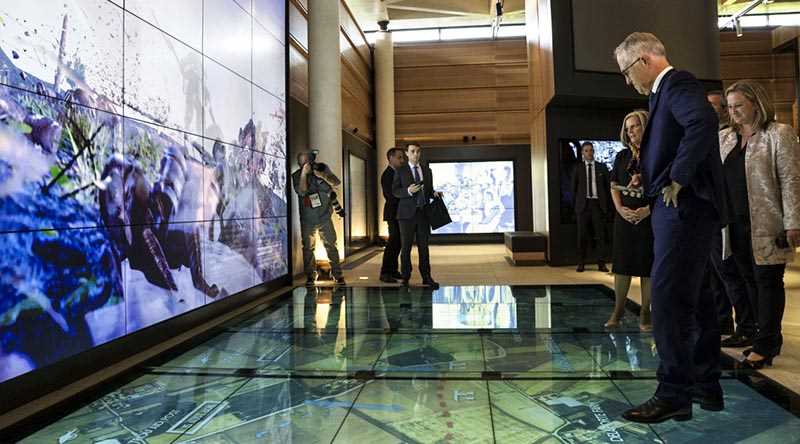
Geospatial Intelligence Proud to Support Sir John Monash Centre
Australian Prime Minister, Hon Malcolm Turnbull, admires the digital displays at the new Sir John Monash Centre in Villers-Bretoneux, including a topographic map of the...Continue reading→
Technologies we work with
Our team builds modern, secure geospatial solutions using proven languages, platforms and frameworks that integrate smoothly into existing environments
Languages and Frameworks
- Python
- C and C++
- Java and Android
- JavaScript and TypeScript
- Microsoft .NET
- Objective-C and Swift
- PHP and Laravel
- Modern web frameworks
Geospatial Platforms
- Esri ArcGIS Pro and ArcGIS Enterprise
- ArcGIS Online and Esri SDKs
- QGIS
- Luciad
- GeoServer and OGC services
- GDAL and open-source geospatial libraries
Where we add value
We design applications that integrate cleanly with existing systems, geodatabases, imagery pipelines and security environments, helping organisations modernise without disruption
-
Multi-Sensor Integration
Bring together imagery, AIS, ADS-B, OSINT, MI outputs and other datasets into unified analytical environments.
-
Workflow Automation
Reduce manual effort, increase speed and ensure consistency across complex geospatial tasks.
-
Operational Decision-Support Tools
Build intuitive interfaces that help analysts, planners and operators access the insights they need, when they need them.
-
Mission-Ready Systems
Applications designed for the demands of defence, security, emergency response and large-scale commercial operations.
-
Bridging Engineering + Geospatial Expertise
Our team includes full-stack engineers who also understand Earth Observation, intelligence workflows and spatial analytics, ensuring the technology supports the mission.

Our track record
Geospatial Intelligence has developed numerous operational systems, including the PressAtlas platform and other mission-critical applications for defence, government and enterprise organisations.
These projects demonstrate our ability to deliver secure, high-performance systems that handle complex geospatial workflows at scale.
Create a tailored geospatial application designed for your mission
Work with our team to design, build and integrate a solution that fits your operational environment