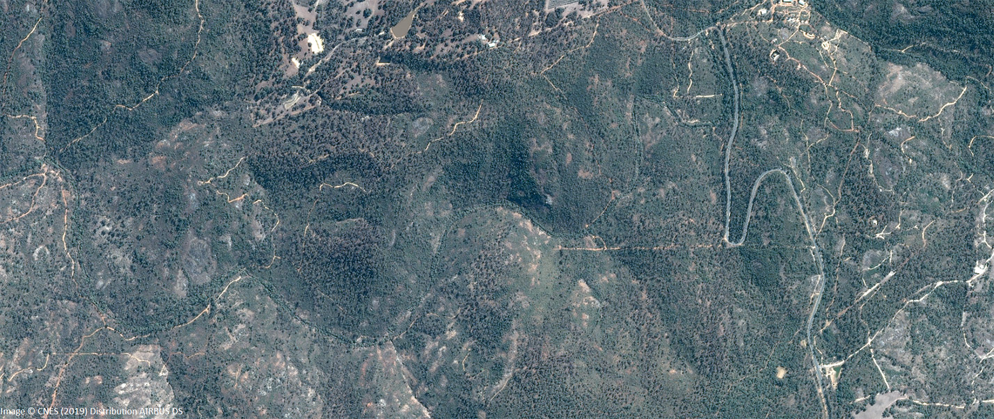
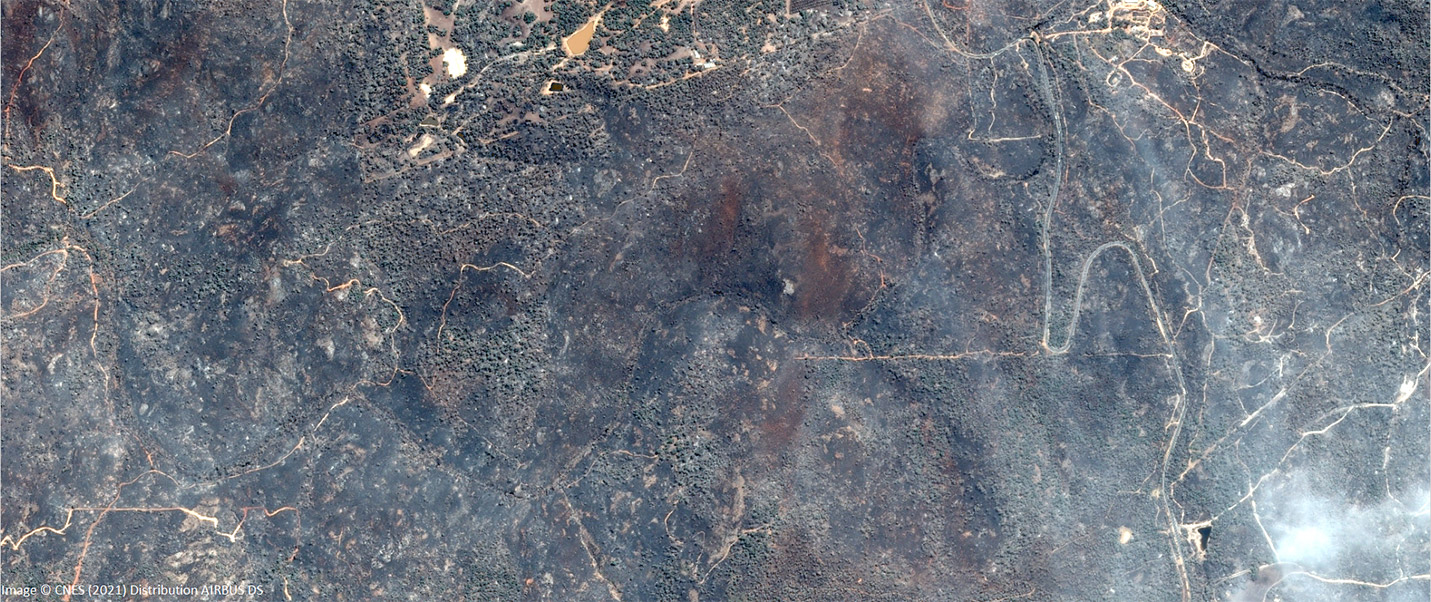
WA Wildfires – satellite imagery delivered in a timely manner.
Australian space company, Geospatial Intelligence Pty Ltd, has continued its well-honed partnership with Airbus Defence and Space to rapidly deliver essential imagery to the Western Australian Government, in response to the Wooroloo bushfire emergency impacting the state in early 2021.
Geospatial Intelligence promptly met the specified requirements of the Western Australian emergency services to provide the state with the data needed to enable a swift analysis of the intensity and extent of bushfire damage over the Perth Hills region.
Submissions to the recent Royal Commission into Bushfires by public Australian entities, including the Australian Space Agency and the SmartSat CRC, have emphasised the need for an Australian capability to enhance available earth observation technologies - in particular remote sensing technologies - to equip Australia to rapidly respond to future bushfire events, both small and large scale. Remote sensing is a critical asset to the monitoring of weather and climate, and in assessing fire location, conditions, extent and behaviour.


A common problem for existing satellite and high-altitude imagery capabilities currently used for analysing bushfires within Australia is that they are frequently obtained from legacy sensors that may not provide timely enough data or revisit rates to be of use for emergency purposes. Another key issue is that these sensors are often too coarse in image resolution for identifying the extent, scarring or ignition points of fires to the level of detail required for an effective emergency response.
However, the versatility and responsiveness of very high-resolution satellite earth observation data makes it ideal for monitoring bushfires. With the assistance of Geospatial Intelligence Pty Ltd and its suppliers, WA is now able to accurately identify the full extent and impact of these bushfires from space in near-real time; tracking fire scars, assessing property and infrastructure damage, and mapping vegetation change close to populated areas. The utility of this imagery can be extended when compared to existing very high-resolution pre-fire imagery, allowing WA to make more accurate temporal land cover change detection and damage assessment analyses.
The imagery in this instance was provided by the Pleiades satellite constellation, a very high-resolution optical sensor with daily revisit times allowing for rapid capture, analysis and delivery across the Earth’s surface. This imagery was delivered within 18 hours of tasking, but can be optimised to deliver imagery of large areas in around eight hours from tasking anywhere in Australia.
Western Australian land information authority, Landgate, processed and delivered imagery enhancements, through its FireWatch system, to emergency services two hours after delivery. Additionally, this imagery was licensed for WA to stream to the public, allowing for wide reaching and effective data sharing.
This is just one example of the advantages of satellite imagery from very high-resolution satellite constellations such as Pleiades, which has rapid revisit times, for emergency response management. Geospatial Intelligence Pty Ltd has previously successfully provided the NSW government with statewide mosaics in 2019 and 2020 to provide a unique insight into the devastating 2019-2020 bushfire season. Through its international partners, Geospatial Intelligence Pty Ltd now has access to numerous very high-resolution satellites with a variety of spaced-based sensors, which allow imaging of the earth numerous times throughout the day and night.

