Welcome to our first ‘Partner-in-Focus’ post! Each month, GI will be highlighting one of our Partners over our social media channels. Our Partner-in-Focus for September is Airbus Defence and Space.
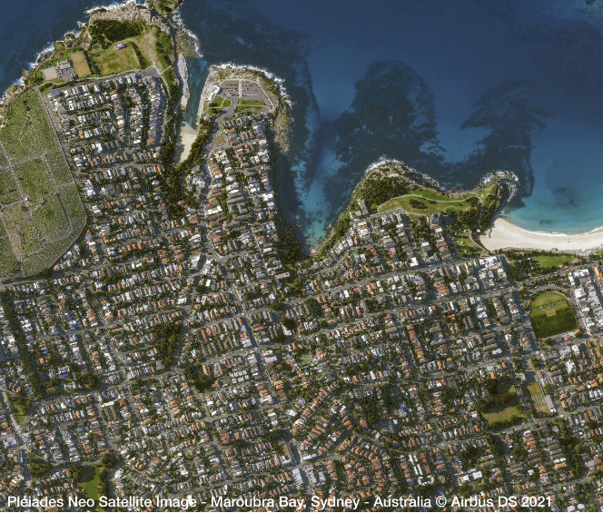
With 30+ years as a trusted partner in Geospatial Data, the recent launch of the Pléiades Neo satellite constellation has expanded Airbus’ extensive range of optical and radar satellite data to include 6-Band, 30 cm very high-resolution optical imagery. This new satellite constellation offers reactive tasking, along with the ability to visit any point on the globe at least twice daily. Each Pléiades Neo satellite will add half a million km² of imagery per day to the Airbus catalogue.
30-cm resolution imagery offers incredible visibility of small objects, such as vehicles and road markings, providing more accurate ground truth for image analysts and reliability for machine learning capabilities. With the inclusion of deep blue and red-edge, and higher geolocational accuracy, Pleiades Neo also allows greater insight into the ocean depths and vegetation canopy.
With launches initiated in 2021, the full constellation of four Pléiades Neo satellites is expected to be deployed by 2022. They are joining Airbus’ two first-generation Pléiades series spacecraft (Pléiades 1A and Pléiades 1B) which were orbited in 2011 and 2012, respectively, and provide 50-cm-resolution imagery.