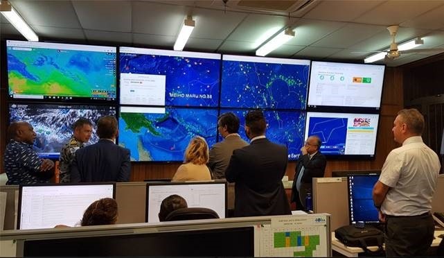
Protecting the Pacific’s Fishery Resources from Space
Australian Company Geospatial Intelligence Pty Ltd, Maritime Domain Awareness experts, in collaboration with exactEarth (Canada), have recently renewed their contract to provide Satellite Automatic Identification System (S-AIS) technology and data to the Pacific Islands Forum Fisheries Agency (FFA) for another 3 years. “We are very proud of our decade long relationship with exactEarth, which represents the ‘best of breed’ space-based technology for vessel detection” says CEO of Geospatial Intelligence Pty Ltd, Mr Rob Coorey.
The Pacific Islands Forum Fisheries Agency (FFA) assists its 17 member countries to sustainably manage the Pacific tuna fishery resources that fall within their 200-mile Exclusive Economic Zones. For over 40 years, the FFA have provided effective policy and technical services to its members to ensure its members enjoy the greatest possible social and economic benefits from the sustainable use of the offshore fisheries resources in the Pacific, including combatting illegal, unreported and unregulated fishing.
S-AIS was initially designed to prevent ships at sea from colliding by enabling them to locate other nearby ships. With the advances in technology and miniaturisation, an increasing number of fishing vessels now have this capacity and are broadcasting their transit and activity details. This system enables fishing vessels to ensure safety of their crew whilst also providing FFA’s members with a useful additional source of monitoring and compliance data.
“Forum Fisheries Agency appreciates the additional texture that exactEarth provides in our maritime surveillance,” said FFA’s Director of Fisheries Operations Division, Allan Rahari. “The AIS feed complements FFA’s own fishing-focused Vessel Monitoring System, enabling us to actively monitor activity in the region. exactEarth supports the FFA to develop a comprehensive regional picture, and to provide a better service to our Members,” said Mr Rahari.

A key role of FFA is to coordinate the essential surveillance support to its member countries. One of the challenges faced by the FFA is the increase in vessels who attempt to obfuscate their true position or activity. FFA have been using exactEarth’s S-AIS system to complement their regional Vessel Monitoring System in detecting vessels that have attempted to remain “dark” and uncooperative. Fortunately, the 60+ platforms in the exactEarth constellation, in partnership with Harris Corporation, can accurately detect the true location of these vessels who are attempting to “spoof” the authorities.
With the ability to locate over 260,000+ ships globally, and view historical and real-time information transmitted from these vessels, FFA are able to continue delivering timely operational intelligence to support its members monitoring activities.
About Geospatial Intelligence Pty Ltd (www.geoint.com.au)
Geospatial Intelligence Pty Ltd (GI), an Australian company, has been providing geospatial solutions to public and private sector customers since its inception in 2002. Geospatial Intelligence supplies clients with an integrated set of geospatial solutions across Maritime Domain Awareness (MDA), Geospatial Information Systems (GIS), Satellite Automatic Identification System (S-AIS), satellite imagery supply and analysis, consulting, training and knowledge transfer services.
About exactEarth Ltd (www.exactEarth.com)
exactEarth is a leading provider of global maritime vessel data for ship tracking and maritime situational awareness solutions. Since its establishment in 2009, exactEarth has pioneered a powerful new method of maritime surveillance called Satellite AIS (“S-AIS”). This service provides a comprehensive view of the location of AIS-equipped maritime vessels throughout the world, as well as other vital vessel characteristics. Under its alliance with Harris Corporation, exactEarth has launched exactView RT, which is the world’s first S-AIS service designed to deliver real-time continuous global coverage of all maritime vessels. This ground-breaking system will allow exactEarth to deliver real-time data and information services characterized by rapid performance, reliability, security and simplicity to large international markets
