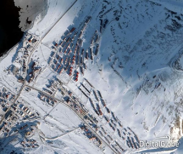
WorldView-2
- Very high resolution (46 cm) panchromatic imagery
- Panchromatic, 8 multispectral bands
- 16.4 km swath at nadir, contiguous strip acquisition of up to 112 x 138 km in single pass
- Responsive system providing near daily revisits
Product Description
WorldView-2
Maxar’s WorldView-2 satellite sensor, launched October 8, 2009, provides 0.46 m panchromatic mono and stereo satellite image data. In additional to the standard RGB & NIR multispectral spectral bands, this sensor provides coastal, yellow, red edge, and an additional near-infrared band. WorldView-2 is capable of collecting up to 975,000 square kilometres each day.
The WorldView-2 sensor provides a high resolution panchromatic band and eight (8) multispectral bands; four (4) standard colours (red, green, blue, and near-infrared 1) and four (4) new bands (coastal, yellow, red edge, and near-infrared 2), full-colour images for enhanced spectral analysis, mapping and monitoring applications, land-use planning, disaster relief, exploration, defence and intelligence, and visualization and simulation environments.
With its improved agility, WorldView-2 is able to act like a paintbrush, sweeping back and forth to collect very large areas of multispectral imagery in a single pass. The combination of WorldView-2’s increased agility and high altitude enables it to typically revisit any place on earth in 1.1 days, revisit time drops below one day and never exceeds two days, providing the most same-day passes of any commercial high-resolution satellite.
The WorldView-2 imaging payload is the second such system engineered and manufactured by ITT Space Systems Division for Maxar. WorldView-2 operates at an altitude of 770 kilometres, and the advanced on-board imaging system can capture pan-sharpened, multispectral images (with better than 0.46-metre resolution) from almost 500 miles above the earth.
These images supply unprecedented detail and geospatial accuracy, further expanding the applications for satellite imagery in both commercial and government markets. Added spectral diversity provides the ability to perform precise change detection and mapping.
In addition to numerous other technical improvements, WorldView-2 also has the ability to accommodate direct tasking.
| Provider | Maxar |
| Satellite/Constellation | WorldView-2 |
| Resolution (Panchromatic) | 0.46 m GSD at nadir |
| Resolution Multispectral | 1.84 m GSD at nadir |
| Geolocational Accuracy CE 90 (without ground control) | <6.5 m CE 90 |
| Swath | 16.4 km at nadir |
| Spectral Bands | Panchromatic + 8 Band MS: Coastal, Blue, Green, Yellow, Red, Red-Edge, NIR1, NIR2 |
| Revisit Frequency | 1.1 days at 1 m GSD or less 3.7 days at 20° off-nadir or less (0.52 m GSD) at 40°N Latitude |

