TerraSAR-X and TanDEM-X (0.25m)
- X-band SAR satellite constellation
- Weather independent
- Multiple imaging modes and polarisation options (0.25m up to 40m)
- High geometric and radiometric accuracy
Product Description
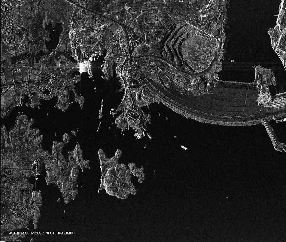
TerraSAR-X and TanDEM-X (0.25m) – TSX and TDX
TerraSAR-X is a German synthetic aperture radar imaging satellite mission for scientific and commercial applications. It has a 1 metre resolution class radar satellite, which delivers Earth observation data for scientific, institutional and commercial users.
The science objectives are to make multi-mode and high-resolution X-band data available for a wide spectrum of scientific applications in such fields as: hydrology, geology, climatology, oceanography, environmental and disaster monitoring, and cartography (DEM generation) making use of interferometry and stereometry. The science potential of the mission is given by:
- The high geometric and radiometric resolution (experimental 300 MHz Mode for very high range resolution)
- The single, dual and quad polarization mode capability
- The capability of multi-temporal imaging
- The capability of repeat-pass interferometry
- The capability of ATI (Along-Track Interferometry)
Both TerraSAR-X and TanDEM-X (0.25m) carry X-band synthetic aperture radar sensors capturing imagery in a number of modes from ScanSAR (270km swath and 40m nominal spatial resolution) to Spotlight (4km swath and 0.25m spatial resolution) with most modes also available as either single or dual-polarisation. Operating in a twin satellite formation about 500m apart, TerraSAR-X and TanDEM-X are collecting interferometric imagery for the creation of a quality global DEM.
Imagery can be programmed on demand. TerraSAR-X was launched in June 2007 and was joined by TanDEM-X in June 2010.
There is a wide variety of applications for TerraSAR-X and TanDEM-X in geology, climatology, oceanography, environmental and disaster monitoring, and cartography, especially DEM generation.
The X-Band SAR delivers radar imagery in following modes:
- Image Mode or Spotlight (up to 1 m resolution)
- StripMap (up to 3 m resolution)
- ScanSAR (up to 16 m resolution)
The Airbus/DLR X-Band constellation currently consists of TerraSAR-X, TanDEM-X and PAZ (in commissioning). TerraSAR-X and TanDEM-X have an orbit repeat cycle of 11 days. The spatial resolution of TerraSAR-X modes is described in the table below.
| Sensor | Mode | Resolution | Swath | Polarisation |
| Airbus/DLR TerraSAR-X | Staring SpotLight | 0.25 m | 4 x 3.7 km | Single: HH or VV |
| Airbus/DLR TerraSAR-X | High Res SpotLight | 1 m | 10 x 5 km | Single: HH or VV
Dual: HH + VV |
| Airbus/DLR TerraSAR-X | SpotLight | 2 m | 10 x 10 km | Single: HH or VV
Dual: HH + VV |
| Airbus/DLR TerraSAR-X | StripMap | 3 m | 30 x 50 km | Single: HH or VV
Dual: HH + VV or HH + HV or or VV + VH |
| Airbus/DLR TerraSAR-X | ScanSAR | 18.5 m | 100 x 150 km | Single: HH or VV |
| Airbus/DLR TerraSAR-X | Wide ScanSAR | 40 m | 270 x 200 km | Single: HH or VV or HV or VH |