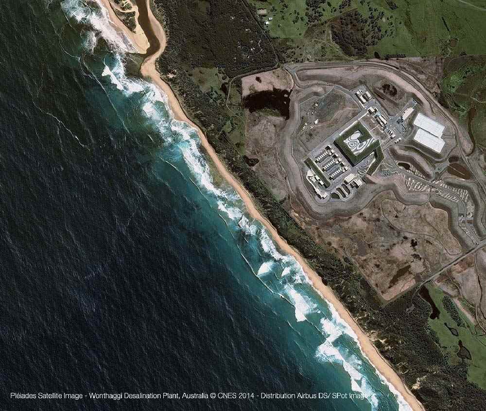
Pléiades
- Very high resolution (50cm) panchromatic imagery
- Panchromatic and multispectral bands
- Ideal for precision mapping at scales of up to 1:2,000
- 20 km swath at nadir, able to acquire up to 100 x 100 km in strip mapping mode
- Stereo capability with a 20 x 280 km swath
- Highly responsive system providing daily revisits
Product Description
Pléiades
The AIRBUS Defence & Space Pléiades constellation is composed of two very-high-resolution optical earth-imaging satellites. Pléiades 1A and Pléiades 1B provide coverage of Earth’s surface with a repeat cycle of 26 days, with 0.5-metre-high resolution satellite image data.
The constellation is designed as a dual civil/military system. It meets the space imagery requirements of European defence as well as civil and commercial needs.
Pleiades-1A and 1B satellites are phased 180° apart in the same near-polar sun-synchronous orbit at an altitude of 694 km, enabling daily revisits to any location on the planet which makes it ideal for mapping large scale areas including engineering and construction projects, monitoring of mining, industrial and military complexes, conflict zones and crisis/disaster areas, natural hazards, evacuation and rescue operations.
The Pleiades satellites are capable of providing orthorectified colour data at 0.5-metre resolution and revisiting any point on Earth as it covers a total of 1 million square kilometres (approximately 386,102 square miles) daily. Perhaps most importantly, Pleiades is capable of acquiring high-resolution stereo imagery in just one pass, and can accommodate large areas (up to 1,000 km x 1,000 km).
The Pleiades satellites features four spectral bands (blue, green, red, and IR), as well as image location accuracy of 8.5 metres (CE90) without ground control points. As the constellation is designed with urgent tasking in mind, images can be requested from Pleiades less than six hours before they are acquired. This functionality is invaluable in situations where the expedited collection of new image data is crucial, such as crisis monitoring.
The Pleiades sensors are an ideal choice for those wanting new imagery collections of an area. For high resolution options, this is a great option for those doing site monitoring or change detection analyses.
| Provider | Airbus |
| Satellite/Constellation | Pléiades-1A , Pléiades-1B |
| Resolution (Panchromatic) | 0.5 m GSD at nadir |
| Resolution Multispectral | 2.0 m GSD at nadir |
| Geolocational Accuracy CE 90 (without ground control) | <8.5 m CE90 |
| Swath | 18.9 km at nadir |
| Spectral Bands | Panchromatic + 4 Band MS: Blue, Green, Red, NIR |
| Revisit Frequency | Daily |